Sunday, February 21, 2016

Highpoint #46: Idaho

At the Highest Point in Idaho!


After a successful climb of Mt. Rainier, it was time to make the long drive back home to Virginia.  Of course, with unclimbed U.S. state highpoints still remaining on my list, the route home was going to be anything but direct. 

After returning to Seattle and collecting all of my gear and having surgery performed on my infected finger (see my Rainier write-up), I opted for a short drive over to Ellensburg, Washington to check into a nice hotel for the evening.  It was helpful to re-familiarize myself with the creature comforts of civilization, get properly clean again, and, most importantly, have a good night’s rest.  It was really nice just to sleep in, in the morning. 

The next day was a down day of driving.  I made my way south into Oregon, cutting through the Wallowa mountain range and passing into Idaho.  I made a pit stop outside of Boise to do some laundry and have dinner.  It was getting late in the day by this point, but I decided to push on to the trailhead for Borah Peak, the highest point in Idaho, which was still another 4 hours away. 

It wasn’t until after midnight that I finally parked at the trailhead.  Other cars were there as well, so I did my best to shut off my lights and not make any noise.  Being that I was going to get up in a few short hours, I did not bother to set up camp opting instead to catch a few winks in my vehicle.  In seemingly no time at all, it was the break of dawn.  It’s “go time”. 

I saw two other hikers from Utah getting ready to head out first.  I asked them if they were taking a rope, and they said they were not.  In fact, it looked like they were not taking much of anything treating the objective of Borah Peak a bit more casually than I was preparing to.  This helped to inform my packing decisions.  In the end, I opted to not take a rope, but I did carry accessory cord, climbing harness, and a few runners, and I left the crampons behind since they necessitated wearing different (heavier) boots. 

I should probably make a note that Borah Peak is unlike most of the other state highpoints, so some care has to be taken about what to bring and what not to bring.  The standard route is done in a single day, but that gives little insight into the difficulty of the objective.  Similarly, one might be misled by the low elevation of 12,667 feet.  In reality, the route climbs 5100 feet in the first 3.5 miles.  That is nearly a 28% grade the entire way to the ridgeline, and I do mean the entire way.  That is just the warm-up though.  The ridgeline itself, also known as “chicken-out ridge” is long and airy.  It is mostly a class 3 scramble, though there is a section of class 4 climbing and a snow bridge with steep drop-offs.   This is the part where most people “chicken out”.  Beyond that there is more climbing to the true summit. 

The problem arises mostly in the class 4 section, as it is also considered by some climbers to actually be low class 5 which would mean taking a rope.  Since the vertical section is short (maybe 15 feet) and climbable in both directions, I reasoned that I could protect it with accessory cord in lieu of taking an entire rope.  I was probably pushing the edge on what is considered safe climbing, but my fears would prove to be unfounded, at least in this section.  As for the crampons, the only portion of the route with snow was the snow bridge, and it was not necessary to have them with the snow being soft.  Obviously conditions can vary though.

One of the Two Signs at the Trailhead

With my final kit decided, I moseyed up to the trailhead proper.  There were pretty good signs speaking to the history of Borah and the climbing of Borah replete with several safety tips.  After a cursory reading, I was off. 

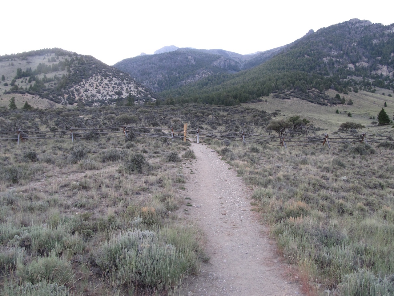
The Starting Point, AKA the Only Flat Section!  

The trail quickly found itself in the upward direction and never relented.  It was strange.  At a comfortable hiking pace, I noticed that I was breathing heavier.  I was certainly well acclimated to the altitude with my previous climbs on this trip.  This was more about the deceptive steepness of the route.  It did not seem that steep, but on average it was a 28% grade.  When there were switchbacks, albeit not often, they were opportunities to gain a lot of height all at once rather than an easing of the difficulty.  Indeed, it was a long, steady march upward into the sky.  

Typical Section on the Approach

There wasn’t much to see along this approach.  The trees became sparser and shorter, and the view back towards the parking area became more distant.  
Finally Approaching the Ridgeline

It was only in the final stretch to the ridgeline that the world opened up in full view.  I now had a sense of place in this mountain range and where the ultimate objective lied.  
Route Ahead:  Summit to the Left, Trail to the Right, Snow Bridge in the Middle

Yikes!  I was swallowed up in the scenery.  Clearly, the path ahead was a very long, rocky crescent that made its way out to a steep depression, across a snowbridge, and then wrapped its way back to the highest point in Idaho (and beyond).  Of course, there was no more “path” to follow.  The path became a faint foot trail and once in the vicinity of the ridgeline proper, one had to infer the best way ahead.  Sometimes there would be an indication of where others had passed before and sometimes not.  A lack of other hikers nearby meant the route finding was entirely up to me. 

While scrambling along the ridge, I ended up being in for a mix of terrain.  Simply walking along the top was rarely a viable option.  So that necessitated picking a side.  The outside looked a bit safer.  So I worked my way from one ledge up to another generally trying to traverse ahead while also gaining elevation.  
Snowbridge Coming Into View
Once I reached the middle of the crescent, it was a bit easier to make progress, with a more up-and-down path presenting itself.  

Ridgeline, Crux Getting Closer

At times though, the outside traverse proved easier.  The downside was that class 3 terrain was at times class 4, so one had to exercise due caution. 


Typical Section Along the Ridgeline

I finally made it to the point where most people “chicken out”!  I looked down from the high rock to the snowbridge and studied the way down for a moment.  There was clearly a channel within which to make my way down with seemingly plenty of holds, for both feet and hands.  

Looking Straight Down the Class 4 Climb to the Snowbridge

It could not have been easier.  I literally descended the troublesome section in less than 5 seconds.  All hype!  The snow was soft, and so it was an easy march across. 

Looking Back:  Gives a Good Sense of the Steepness

On the other side of the snow bridge, I made my first mistake.  I assumed that I needed to stay on the ridgeline with its ups and downs and occasional workarounds.  I totally missed the footpath on the inside of the crescent that bypassed most of this more difficult terrain.  So I ended up with a more sporting outing.  I may not have ever realized my error if it were not for the hikers from Utah returning from the summit motioning towards the lower path that they were following back.  Oops.  I asked them how it was to the summit, and they said it was more of the same, “nothing harder than what you have already done”. 

Still More to Climb!

Those reassuring words proved to not be the case for me.  Indeed, I wish I had struck out with these chaps in the morning to avoid all of the nonsense I would soon be in for.  I seemed to have an instinct to avoid or entirely miss the easiest route.  What lied before me, for nearly the next 2 hours, was a search for a path to the summit.  I was so close, yet so far.  I began by making my way to the ridgeline via a direct beeline.  Holds gave away to slabby terrain.  At one point I ventured into clear, low class 5 terrain.  Not the way to proceed!  I very carefully descended the slab, hoping not to begin an unstoppable slide.  With no sticky rubber rand on my hiking boots, I needed to find the class 3 way out of this mess.  I traversed a bit more and tried going high again, once more to no avail.  

Gaining the Ridgeline was Actually Tricky

I descended some, traversed more over some short icy sections and made my way back up.  Finally, I could gain the ridgeline proper, and from that point to the summit it was surprisingly easy!  When you are going the right way, the whole thing becomes much more doable. 

Last Stretch (Finally Back on Trail)

At the summit, there were a few strewn rocks more or less in a pile.  Amid the rocks, was a canister containing the summit register.  Underneath some of the other rocks were various flags, and, curiously enough, under another rock there was a rubber chicken covered in flies.   

Summit of Borah Peak Replete with Register, Flag, and Rubber Chicken

I liberated the chicken and really got a kick out of it.  I guess it was there, tongue-in-cheek, for the “Chicken Out Ridge”.  It was good to see a sense of humor out here.  I also made an entry in the summit register, officially confirming the completion of my 46th state highpoint – yay!  Only Wyoming, Montana, Alaska, and Hawaii remain.  Only one of those is actually easy though. 

View From the Top:  Note Lake Below

I spent some time taking in the views.  They were exceptional, and the remoteness of the place was palpable.  After tarrying for a bit to savor the place, I tidied up the summit area and prepared my descent. 

Another View from the Top

If it wasn’t exactly clear how to climb this last peak, it wasn’t exactly clear how to descend it either.  I more or less kept to the last path that actually worked.  After descending about half way down the peak, I saw a party making their way towards me.  Excellent!  I could extrapolate the rest of the route from me to them and from them back to the snowbridge.  When they asked me the way up, I just indicated the path I was following down.  I let them know though that I was winging it for a lack of an obvious path to follow.  I wish someone had the idea to spray paint blazes to clear up the confusion for the easily confused.  Oh well. 

I made my way back to the snowbridge without having to climb along the ridgeline, which was quite a bit faster and easier.  I crossed the snow once more, and now I was faced with a vertical climb.  This was definitely harder than the descent, but it was pretty quick to dispense with.  All I needed was a good foothold, and I was good to go.  Finally on top of the ridgeline, I made my way up and down, again and again, occasionally going around a gendarme.  I saw another hiker pass, heading towards the summit and making very good time over the tricky rock.  Nice.  All was similarly good for me until I made my way to the last part of the crescent.  At that point, my climb completely fell apart. 

This was most perplexing to me.  I was nearly done with all of the climbing, and I was simply crossing over the very same terrain that I climbed over on the ascent.  Somehow, it was different.  My attempts to complete the traverse and come off of the ridge were seemingly blocked by terrain that was decidedly more difficult than class 3.  I worked my way farther down the mountain, and at that point, my one trekking pole lost its inner section and fell the rest of the way down the cliff face.  I did not need the poles to complete the climb, but I was not too happy about losing $150 worth of trekking poles, either.  I descended even farther, until I reached a definite ledge.  It was a no-go point that beyond was class 5 the rest of the way down to the valley below.  With a real rope, I could rappel the route, reclaim the lost pole section, and walk out and eventually regain the trail.  With accessory cord, this was not going to happen. 

I considered the poles lost, and tried to figure out how to get out of this pocket of terrain that was giving me difficulty.  Fortunately, the very adept hiker who quickly passed me as I was returning from the summit was now returning.  As he approached, I called out to him to see if he knew the best way out.  His name was Peter.  He, too, had passed this very way on the ascent and noticed that it seemed more difficult to descend.  He probed around a bit and found a passage out.  It involved pushing downward on a large sloper in order to traverse a sketchy spot.  I did not even rule this way into consideration when I was looking on my own.  A fall there would have made for a long tumble down the cliff.  Peter guided me through it, and the rest of the way was considerably easier.  We chatted for a bit, and I thanked him for his timely assistance, and then he was off, preferring a speedier descent. 

Wow, I really need to pay more attention when routefinding!  This was not good terrain to get sidetracked in.  While there were plenty of ledges, some of the rock was pretty chossy, so it was sometimes a guess if a hold was going to be solid or not.  Oh well, I was glad to be done with the difficult portion of the climb. 

The rest of the descent was easy and fairly quick.  At times, I had to hold myself back from descending with too much momentum given the steepness of the route.  With time, the parking lot came back into view, and I eventually made my way back to my vehicle.  I stowed all of my gear and was off to Idaho Falls for the night.  I had a lovely steak dinner and checked into another comfortable hotel room. 

Sadly, this was not enough to promote a full recovery.  Indeed, I woke up in the morning feeling really sick.  My immune system was at a low, likely from all of the driving and climbing over the past couple of weeks.  I spent the next few days visiting Grand Teton National Park and Yellowstone National Park, but I never felt any better.  Rather than try for either of the Montana or Wyoming highpoints (both, long difficult backpacking trips), I decided to drive home and cut the trip short.  It wound up taking me about a week to feel good again, so it definitely proved to be the right call. 

All in all, I had an amazing road trip -- over 7000 miles of driving and 4 new highpoints!!  And by deferring Montana and Wyoming to next summer, I now have another great road trip to look forward to – yay! 


P.S.  I visited REI after my trip and was able to exchange what remained of my trekking poles for a new set of poles.  They replaced the defective poles, no questions asked.  Wow! 

Sunday, August 16, 2015

Highpoint #45: Washington

View Across the Crater from Columbia Crest, the Highest Point in Washington!


My cross-country road trip was in full swing at this point.  Having left Virginia, I already managed to climb the highest mountains in Colorado and Utah, and now I was on my way to Seattle.  That being said, my climb of Mt. Rainier, the highest point in Washington, was scheduled as a guided climb.  Since the dates for the climb were fixed nearly a year in advance, running ahead of schedule, as I now was, meant that I would simply have to wait until the appointed date.  This was not too problematic though since I was in one of the most scenic parts of the country to have some downtime. 

I managed to camp out in Glacier National Park and see what few glaciers still remain there.  I then continued on to Mt. Rainier to have an advance look at the mountain and the climbing route.  After taking in the views of one of the most beautiful stratovolcanoes in the world on one of the fairest days, I spent the night at Whittaker’s Bunkhouse just down the road from Paradise.  Whittaker’s was of course RMI territory (the original and most well-known guiding service for Mt. Rainier), so I could not resist experiencing a part of mountaineering history by visiting there and having a Rainier beer served by none other than Peter Whittaker himself.  The day was an inspiring one! 

The Objective:  Mt. Rainier!

Driving into Seattle the next morning meant that I managed to drive my car all the way across the country – yay!  First order of business was visiting Alpine Ascents (my guiding company for the trip) and doing a required gear check.  This was a straightforward affair and went pretty easily, since we all had previous mountaineering experience.  It was a good chance to meet the other climbers though. 

Our chosen route up Mt. Rainier for this expedition was the Kautz route.  It is a more involved, intermediate level route that involves a little bit of ice climbing as part of the summit bid.  It is definitely not a route for the uninitiated.  Indeed, all the beginners typically go up the comparatively easier Disappointment Cleaver route (also located on the south side) or sometimes the Emmons route, which is on the north side of the mountain.  Being a more demanding climb, everyone at the gear check was already pretty experienced.  Some had summited Rainier before by one of these other routes, some climbed Mt. Baker and had completed mountaineering school, and others had varied climbing experience in the Cascades and beyond.  One had even climbed Denali (the highest point in Alaska)!  My experience was an 8-day mountaineering school that I did with Alpine Ascents two years ago on Mt. Rainier over on the Winthrop glacier.  Additionally, I soloed Mt. Hood and had done a few other mountaineering climbs, so this was the next logical step in my climbing career. 

After the gear check, I went over to my AirBnB apartment along the waterfront to check in for the night, a new first for me.  My host was absent, but I was able to still get into the apartment eventually.  I deposited my bag, went out for some sightseeing and dinner, and came back later in the evening.  Later back in the apartment I met up with the host, talked a bit, and called it an early night since I had to be up first thing in the morning. 

I “checked out” of my AirBnB apartment at 5:30am and began walking over to the Alpine Ascents office located about a mile away.  I had plenty of time to make the 6am rendezvous, so I enjoyed a pleasant walk in the cool morning air.  When I arrived, I saw several of the other climbers in line in front of the door.  Apparently, no one with keys to the building had yet arrived.  After about 10 minutes, one of the Alpine Ascents staff arrived and let everyone in.  We quickly claimed our bags and brought them out to the mobile trailer, making sure to separate out all of the sharps (ice axes, crampons, etc.).  We loaded up rather quickly and made our way out of Seattle. 

The ride to Ashford was quiet and scenic.  We had a view of Mt. Rainier for most of the trip in, which afforded us ever more striking views of the volcano as our distance to it narrowed.  Our progress was zippy and contrasted rather well with the standing traffic trying to make its way into Seattle.  Once we pulled into Ashford, we stopped at Whittaker’s.  Hey, I know this place!  I had no idea that Alpine Ascents got on well with RMI; it was good to see this camaraderie between competing guiding companies.  Better yet, I was in for a decent breakfast before starting the climb.  Red-eye coffee and an egg, ham, and cheese bagel?  Yes, please. 

After breakfast, we assembled again and made our way into the national park.  We were all issued our individual climbing passes (good for the entire calendar year), and we proceeded up to the visitors' center in Paradise.

Good for the Entire Year!  Wish I Lived Here!  

Now it was time to get down to business!  I changed out of my street clothes and into my climbing clothes and set aside some fresh clothes in the van to change into for the return trip back.  I gathered my share of group gear (food, fuel, and pickets) and half of a tent, and repacked my backpack.  Waiting around for everyone to finish and get started, I took some pictures. 

Alpine Ascents Van and Trailer and Two Guys with Icy Stares Blocking the Shot

Some visitors to the park stopped by and talked to us about the climb.  One lady asked if she could lift my backpack to get a sense of what we had to carry.  With the pack weighing in at more than 60 pounds, she was unable to lift it off the ground.  She took in a clear view of the summit and then turned back towards us, laughed, and dismissed us as “crazy”.  That was a seemingly fair assessment of what we were about to do.    

Van Parked and Getting Ready to Rock

Now it was go time!  For the next 4 days we would be on the mountain.  We were 12 in all which broke down to 8 climbers and 4 guides.  We proceeded up the steps, emblazoned with John Muir’s words, more or less in line-file and followed the paved path up and away. 

John Muir Endorses this Climb

Soon the tourists thinned out and then all but disappeared.  We made our way over to Glacier Vista where we searched for the best place to descend onto the Nisqually glacier.  We worked our way down a rocky cliff keeping to a largely class 2 route.  

Off the Paved Trails, Approaching the Nisqually Glacier

Once we were down to the glacier proper, we took out our climbing harnesses and roped up in teams of three.  Of the four guides, I, by chance, wound up with the most famous one:  Lakpa Sherpa.  Seriously, he has -- summited -- Mt. Everest 17 times and has his own clothing line.  He is the mountaineering equivalent of a rock star.  I clearly was in very capable hands tied into his rope.  Of course, the initial terrain hardly merited someone of such stature to guide me through it, being relatively straightforward and all, but it was an honor nonetheless to have that experience.  

Roping up with Lakpa Sherpa

The glacier was thinner at this lower elevation and was interrupted by moraines as we crossed it.  As we started to gain altitude along the glacier, we could see crevasses and began crossing snow bridges. 

Typical Terrain Along the Way

We made our way over to the Wilson glacier and made our way up one snowy hill after another.  

One of Our Breaks Along the Way

A few hours later, we walked into camp.  It was a relatively nondescript place and one could easily miss it, but had the advantages of a large flat area to set up tents and a cleaver like formation that served as a windbreak.  

First Campsite; Mt. Adams in the Distance

We established camp, and the guides made us dinner and hot drinks and served us Oreos for dessert.  The guides were always good about getting snow and melting it down for water and refilling our water bottles.  As climbers, we got to sit out these activities and just enjoy the views – definitely easier going than the mountaineering school where we were expected to be entirely self-sufficient!  It was a solid first day, and we were all good for the wear.

Set Up Camp with View of Mt. Adams in the Distance

The next morning we woke early to hot drinks and breakfast.  We packed up camp with the objective of proceeding towards the icefall visible off in the distance at around 11,000 feet in elevation.  The icefall always seemed relatively close, but we still had to make our way up one long hill after another, zigzagging our way up, kicking steps, and taking rest steps.  With heavy packs, it was a slow-going affair.  Again I was tied in with Lakpa Sherpa, and we were the lead team heading up.  Our moderate, purposeful pace was uniformly kept across all of the teams. 

The improving views informed us of our progress.  Along the way we stopped to allow a team to descend by way of our path.  Apparently, the IMG team had summited just the day before and was heading down.  Our guides conferred with their lead guide for beta on the route.  We were in for 4 pitches of easy to moderate ice climbing and large ‘penitentes’ (suncups) along the upper route.  While the Kautz route is never quite the same route twice, the scouting report indicated that everything was going to be straightforward and within expectation. 

We continued up more hills and finally arrived at our second camp, a bit below the icefall.  Evidently there was a party already camped at the higher spot, so we settled for a lower camp.  This was fine by me really, as there is no need to carry a heavy pack any higher than is necessary. 

The downside to the lower campsite was the narrow shelf within which we had to pitch all of our not-so-narrow tents.  My climbing partner and I got dibs on the worst spot, so we were in for quite a bit of work trying to remove rocks and widen the area enough for a tent platform.  Fortunately some of the groups of three finished early and helped our group of two towards that end.  We made up camp for the night and had a group review with two of the guides.  We made slings with our accessory cord that we would clip into anchors along the ice route the next morning.  We discussed rope management and reviewed expectations for the upcoming summit bid.  

Afterwards, we broke up and waited for dinner.  Bangers and Mash!  This hearty fare really hit the spot and was calorically dense enough to fuel our summit bid which was only hours away now.  Indeed, we were told to go to sleep early.  Our lead guide would come around to the tents and wake us up at around 1am for an alpine start. 

I checked in with my tent-mate who was not feeling so well by this point.  In fact, he felt quite awful.  His best efforts to treat his symptoms were to no avail.  He decided to sit out the summit climb.  I encouraged him to get some rest and see how he felt at the appointed hour to leave.  He obliged, but in the end though, he did opt to stay behind. 

It was 1am in seemingly no time at all.  Up and at it!  We had our hot drinks and breakfast and dressed for the climb.  Our packs were considerably lighter, in the 20-30 pound range, and they felt even lighter than that given the excitement for the summit bid.  Since my tent-mate stayed behind, Lakpa Sherpa stayed behind with him to mind him during our absence.  Given that, this time I roped in with our official lead guide for the trip, Brent Langlinais, who led the first team out.  (Technically all 4 of the guides were of lead guide status, but he was designated the lead guide for this trip on paper). 

We made our way up to the icefall and over to a narrow edge with a down climb.  There was an emplaced fixed line, which seemed superfluous since the down climb was, while awkward due to a jutting rock formation to work around, pretty easy going otherwise.  We had to wait for a team ahead of us to descend.  Once we descended, we made our way over to the Kautz ice route and anchored in.  We were in for a traffic jam.  There were at least three other teams already on the route.  This is the busiest the guides had ever seen the route.  Indeed, this route sees very little traffic in general and is known for being a much quieter way to summit.  Go figure. 

The Easier Ice Climbing After the Sun Came Up

We waited for the teams to advance, which took a while since they were not so swift in their movement.  Worse, they kicked the occasional ice down the route.  Brent was annoyed, not being a man who likes to wait.  We did get our turn to go up though.  We made our own line up the right-hand side of the route.  The first pitch proved to be the crux with jutting, bulbous ice to work up and over.  We made pretty good time and anchored in for the second pitch.  It was fairly dark out, but we could see the Milky Way in the night sky amidst a brilliant star field.  Even the nighttime views are incredible here!  The second pitch petered out about half way through, and we found ourselves on a flat section thereafter.  

Making Good Progress!

Crossing this football field of sorts, we anchored in for the third pitch.  At this point, the sun began to rise.  We could see the mighty shadow that all of Mt. Rainier was casting well off into the distance.  The scale was grand!  

Mt. Rainier's Shadow

The fourth pitch was more a formality than anything.  There was less ice and more suncups.  They were very large and always provided a good footing amid the gaps between them.  

Suncups Eventually Dominated

All in all, the climbing through these pitches was engaging and never particularly difficult.  I did manage to take a whack of ice to the helmet though that someone climbing above had kicked down, so it is smart to wear a helmet and anchor in between pitches. 

Ice Route Finished, Normal Climbing Now

Having completed the ice climbing, we were back to our routine glacier travel.  Again, it was a series of snowy hills connected by snow bridges, with the occasional gaping crevasse on display for full view.  

One of the Sections that We Crossed

After a while, we found ourselves approaching the crater rim.  

Almost at the Crater Now

At this point, we took a short cut that went straight up to the rim over a particularly narrow snow bridge rather than proceeding up and around.  The bridge held, and we had made it to the top!  All 11 of us!  Sort of. 

The Crater Rim!

Some people consider making it to the crater rim as a successful summit.  In fact, some guiding companies will only go as far as the crater rim, saying that there usually isn’t enough time to make it to the highest point.  (I chose Alpine Ascents specifically to avoid this problem).  Geographically, the entire crater rim is not at the same elevation.  Some parts of the rim are higher than others.  The highest point along the rim is called “Columbia Crest”, a point which lay diametrically opposite (and higher) from where we had “summited”.  Being a blog about climbing to the highest point in every state, where we had summited was insufficient.  No worries though.  Our guide was well aware of the distinction and fully intended to take us over to Columbia Crest, though he did allow that the trek across the crater was entirely optional. 

We did just that.  Unroped, we traipsed across the crater itself, which amounted to a fun walk in the snow, albeit in excess of 14,400 feet in altitude.  At the other side, there was a very slight hill to climb.  We made it to the top and officially were standing at the highest point in Washington state!  Yay!  My 45th state highpoint!  

View from the Top!

We lingered for a bit and took some photos.  Brent asked if anyone was interested in signing the summit register located a little farther down, but no one was particularly in the mood; me included.  Alpine Ascents submits the names of all the successful climbers anyway to the National Park Service, so it is really just a formality. 

Vanity Shot from the True Summit (Liberty Cap in Background)

After everyone had their time at Columbia Crest, we crossed back over the crater rim and roped up again for the descent down.  This was fairly fast going for a bit.  We quickly dispensed with hills and crossed snow bridges in no time at all.  That is to say until we reached the ice field.  Those 4 pitches could not be descended in a hurry.  In fact, it took forever.  The approach agreed to by the guides was to lower us, team by team down each pitch.  This was a very time-consuming process, all the more apparent being the first team to descend and having to wait for everyone else to catch up.  Easily a couple of hours had passed to get through those 4 pitches.  During one of our pauses, an entire slab of ice from the adjacent, overhanging icefall had fallen causing a crashing boom.  Yikes!  This was not the safest place on the mountain to tarry, especially with the sun rising and the snow softening.  

Ice Cliff that We Paralleled in the Morning Would Prove Dangerous in the Afternoon

If Brent was annoyed having to wait for his chance to ascend, he was definitely annoyed wasting so much time descending.  He was noticeably agitated.  He even had to change up his plans by descending first rather than last so as to build a v-thread anchor for us in order to safely descend the final pitch.  Once we all descended, we proceeded over to the fixed line and made our way up.  This should have been straightforward.  Alas, Brent started yelling and swearing at me that I was stepping on the rope.  I continued forward as I could clearly see that my foot was not on the fixed rope.  Much to my chagrin, my foot was on the climbing rope though.  I failed to note which rope he was referring to during his yelling which resulted in more yelling.  Yes, a long day left our guide a wee bit agitated. 

At any rate, we were safe now only a few hundred yards from camp.  We made our way down, dropped our packs, and changed into more comfortable clothes.  Lakpa made everyone Ramen noodles which helped us rehydrate.  After lunch, we all turned in for an afternoon nap.  That hit the spot.  We woke up, prepared dinner, and retired again for the night.  Brent was considering moving our camp lower, but there was seemingly a lack of concurrence among the other guides for this option.  I am not sure what the point would be either.  Breaking camp and setting up camp again is a fairly time-consuming process, and heading entirely downhill on the last day means it would only save us an hour or so in net time expended. 

Breaking Camp on the Final Day

On the fourth and last day, we had our breakfast and hot drinks and broke up camp.  Descending was fast and easy.  We made our way down one slope after another with the surrounding terrain whizzing by.  Again I was tied in with Brent for this leg of the trip.  What I had chalked up to agitation the day before was more pronounced on this day.  I sensed that his remarks were more pointed and directed at me.  For example, when I remarked that the lower portion of the Wilson glacier looked a little bit different to me than it did on the way up, he went off in a monologue about having good mountain sense, the importance of always looking around, etc.  It was just an offhand remark, almost rhetorical.  Really, this merited a lecture?  When we had finally crossed the Nisqually and were getting ready to un-rope, Brent took the opportunity to yell at me in front of everyone that I was “again” standing on the rope.  Something was off with this guy.  So when we had the chance to continue down on our own accord, I quickly broke away from Brent and tried to catch up with some of the guys who started up the cliff.       
            
Under the rules of the concession, you still had to be within eyesight of a guide, even though we were off the glacier at this point and simply hiking.  So I followed another guide’s lead, Matthew Nightengale.  Rather than going straight up the cliff we had originally descended, we decided to follow along the cliff farther down into the valley.  We apparently were following a “new” route (later termed the 'Lakpa Direct') that Lakpa was taking his lead group along.  The route was very scenic, but there were two downsides.  One, Matthew did not know the route, so he was always attempting to infer the route which led us to backtracking a few times.  Two, the route had us crossing fields of wildflowers.  We trampled them one after the other, which was heartbreaking.  Indeed, one of the visitors to the park scolded our group about this reprehensible undertaking.  So much for leaving no trace.  Eventually we made it back up the paved trails.  We walked around throngs of tourists and made our way back to the visitors' center.  

Ah, civilization!  It felt really nice to change into clean clothes and grab some rehydrating drinks at the visitors’ center.  We left the park and went once again back to Whittaker’s for a post-summit beers and burgers gathering.  I grabbed my beer and started heading out to the main field where all of the picnic tables were.  Brent was coming in and told me to go ahead and grab a table.  I found a nice one, away and in the shade and waited for my lunch order to be brought out.  No one joined me; not noticing me, they all opted instead to sit at the main table by the kitchen.  Brent came over to my table and asked if I directed them to sit there?  Huh?  He explained that that table was the summit table reserved for RMI climbers returning from expeditions.  He got the okay from Peter Whittaker that it was okay for our group to sit there though since RMI did not have any climbers returning that day.  Really, he wanted to know if I orchestrated this?  I was clearly sitting more than 200 yards away from said table all by myself.  I declined his offer to join them opting to “celebrate” alone.  I could explain away some of his personality irregularities as part of the climbing experience, but this was ridiculous.  At this point, I had enough interaction with Brent to conclude that he was just an asshole who felt some need to focus his exasperation on me.  Eventually we all gathered together again and drove back to Seattle.  Whew, glad that was over! 

As soon as I arrived back, I turned in my rental items (avalanche transceiver and ice tool), and asked for the nearest emergency clinic.  My right ring finger was badly infected and was cherry red by this point!  There was a clinic a few blocks away, so I asked if I could leave my bags while I went over to get treated.  The gear manager obliged, and I went over for a long wait at the clinic.  The physician assistant performed surgery on my finger, drained it, and put me on an antibiotic.  Wow, of all the climbing injuries one could get, I would not have guessed this one!  

Infected Finger.  Really?

I hurried back to Alpine Ascents and gathered my bags.  Nick Mullan, the fourth guide, was kind enough to carry my backpack to the street.  What a nice guy!  The staff called a taxi for me, but the taxi never came.  The office had since closed, and my phone was dead.  Ugh.  I had to walk a mile with two backpacks to the parking garage.  Oh what fun that was!  Oh well, one of the hardest climbs was in the books.  Time to head to Idaho! 


Addendum:  I am generally fine with using Alpine Ascents, and I do recommend them.  In fact, I have since signed up for their Volcanoes of Ecuador trip.  Just be careful about who your guides are, and be prepared to adjust accordingly.  In any business, you are bound to encounter an asshole or at least someone who rubs you the wrong way.  So goes it; no need to take away from the bigger things that you are trying to accomplish in life.