Saturday, February 9, 2013

Highpoint #17: Kansas


Return Cross-Country Highpointing Trip, Stop #1


Vanity Shot at the Summit

For the return cross-country trip home to Washington, D.C., I opted for a different route.  I still wanted to visit a few more highpoints, but I realized that, being winter, my options were decidedly limited, all the more so since I visited so many highpoints on the way out.  I finally settled on a route that swung north from New Mexico so as to include the highpoints of Kansas and Missouri, before swinging south enough to claim the highpoint of Mississippi (I missed it on the way out), and then ultimately heading home.  The highpoints were all a little bit out of the way, but there is no clean and easy way to visit these places.  Luckily I had my fiancĂ©e in tow, which made it a not so lonely endeavor this time around.

It's All Off-Road from Here!

Now Kansas has a reputation of perhaps being the flattest state in the country, so I was not expecting much from its highpoint.  Indeed, my biggest concern was in being able to get there.  Reading through the directions, I noticed there was plenty of off-road traveling.  That worried me a bit with the snowstorm that had recently passed through the area.  I had no way of knowing the local road conditions though, so I figured I would just see what they looked like by the time I got there and prepare for a long hike if need be.    

One More Mile!
As we zigzagged through eastern Colorado, alternating between heading due east and due north, we eventually made it the Colorado/Kansas line.  The highpoint of Kansas is about a half mile from the state line, so we knew we pretty close, longitudinally speaking.  We turned off of the main highway onto Road 3, which was bedecked with a small sign that said, “ Mt. Sunflower / 12 Miles”.  The road was an unpaved farm road that was in generally great condition.  Snow was minimal, so I could really keep up a good speed.  Any concern I might have had about having to “snowshoe” in, was quickly allayed.    

Made it!
Eventually, after the 12 miles had past, in seemingly the middle of nowhere, there was another sign indicating for me to turn left and continue for one more mile.  The road retained its character, but the sense of remoteness was beginning to grow.  Shortly though, we reached a junction.  Ahead, there was a sign indicating “No Outlet”, and to the right, a handmade yellow sign that indicated “Mount Sunflower” with a little hand-drawn sunflower on it.  The highpoint was visible in the distance and we were happy to have made it all the way here.  Yay! 

View of the Summit Shrine

As I suspected, the area in the vicinity of the highpoint was quite flat.  Nonetheless, the elevation rang in at an impressive, 4,039 feet!  Like I wrote, we were really close to Colorado, which might have been the influential factor here. 

Trail Register -- 4039' Elevation

Mt. Sunflower is one of the few highpoints that is on private property, which can have its own set of issues associated with it when it comes to accessibility.  Fortunately, the owners of the farmland are very accommodating and keep the highpoint open to visitors every day, all year round (which is not always the case with other such highpoints).   

Family Marker to Commemorate their Homesteading (Note the Crack)


Definitely in the Right Place!

The shrine commemorating the highpoint is quite elaborate!  It sets within a fenced-off square of land.  Inside, there is a large wrought iron sign that boldly labels the spot “Mt. Sunflower” and “Highest Point In Kansas”.  There is a small boulder within which presumably is a stand-in for the summit.  There is also a large “sunflower” made from railroad spikes that emanates from it.  Behind the rock, there is a very large stone marker that is suspended which commemorates the fact that the owner’s family has been homesteading in this area since 1906!  Finally, to the left there is a mailbox that contains the summit register within as well as a newspaper clipping which details a recent case of vandalism that occurred on the site.  Here is a link to a news article that gives more information on the incident and explains why the stone marker is cracked: 


Sad.  Who Would Vandalize this Site?

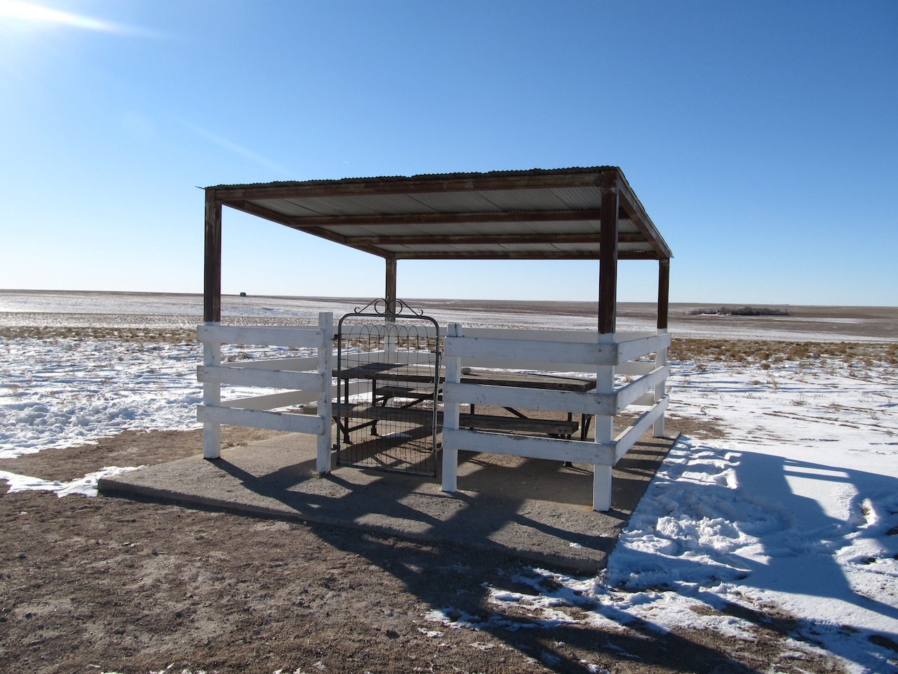
After signing the register, we paused to take in the view, but it was pretty much the same in every direction.  There was a picnic shelter conveniently located next to the highpoint, but we were not equipped with packed lunches to properly take advantage of it.  Perhaps on a nicer day, it will find good use among those who know about it. 

Picnic Shelter Next to Highpoint

All in all, I was pretty happy with my visit here.  The owners managed to make a nondescript piece of land feel pretty special and even imbued a sense of history into it.  I love that I drove in the middle of nowhere to find it too.  It was a small adventure, but a very memorable one all the same.  

View from the Top!  (yeah, I know...)


Sunday, February 3, 2013

Highpoint #16: Texas


Cross-Country Highpointing Trip, Stop #9


The highpoint of Texas is Guadalupe Peak located in Guadalupe Mountains National Park in west Texas.  I can’t say that I have ever heard of this national park before, which is a shame as it is definitely worth a visit.  The park is remotely located with no services in the vicinity.  It is near the Texas / New Mexico border, about a one hour drive to Carlsbad Caverns National Park and more than a two hour drive to El Paso.  There is not much to offer along a good part of those lonely stretches either, except wind.

"Top of Texas" -- Definitely in the Right Place!

Seriously, the wind was intense on my approach, my visit to the park, and upon leaving the park.  It just would not let up.  It was quite strong, and there were many signs along the roadside warning of its danger.  For much of the time it was not even safe to drive the speed limit, because the wind was pushing my car around so much on the road.  In portions of the trip, the windstorm turned into a dust storm reducing the overall visibility considerably.  All told, it was a god-forsaken part of the country that I would be happy to leave.  I just had to get a moderate length hike out of the way first. 

Der be Mountain Lions in Dem Der Hills!
I pulled into the park at night and camped.  Despite it being winter, many others had the same idea.  Nearly all of the campsites were taken on my visit.  I couldn’t believe it!  For a park I never heard of, it sure was a popular place to be. 

The Trailhead has 4 Overlapping Trails

I woke up pretty early the next morning, and I was impatiently waiting for the sun to rise.  I logged my name on the register, paid my fee on the honor system, and read all of the information at the trailhead.  There was, like Oklahoma, a warning about rattlesnakes with the added admonition that they were protected meaning that killing one is considered a crime.  That was novel.  Better yet, there was a warning about mountain lions as well!  Cool.  I was definitely getting off the beaten track a little bit.  I suspected that I would be in for a prettier hike as a result, and I was right. 
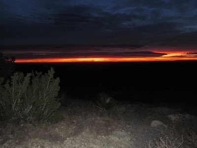
Early (Alpine) Start on the Trail

Even with all of these preliminaries, the sun still had yet to rise.  I decided to just head off on the trail anyway with my trusty headlamp.  There was a smidgen of light, so I figured it couldn’t be long.  I was very anxious to get started, and I knew that there would be a long drive ahead of me afterwards; so in my mind, there was simply no time to spare. 

Sunrise Over the Park

The trail to the peak is pretty obvious.  It is 8.4 miles in length, round-trip.  It is billed as “strenuous”, but I would put it at moderate.  There is no scrambling or anything technical about the terrain.  Route finding is fairly obvious, too.  Indeed, there were a couple of signs just off the trailhead to distinguish the Guadalupe Peak Trail from the other overlapping trails (Devil’s Hall, El Capitan, and The Bowl).  After that, there is only one trail to follow.  It is wide and easily distinguishable, so there was no need for blazes. 

The Sun is Finally Making an Appearance!

The trail spends a long time over a series of switchbacks so as to gain elevation quickly.  From the trailhead, there are clearly two mountains that are visible.  I assumed the mountain that I was climbing was home to Guadalupe Peak.  It was not.  This became apparent, when I nearly approached the top of the mountain, and the trail had me swing around to the other side of it. 

Shot of the Trail Near the Summit of the First Mountain
From the other side of the mountain, I could see yet another mountain off in the distance.  The trail changed its character a bit, and followed a ridgeline.  I began hiking along the backside of the mountain and connecting over to the other mountain.  At one point, I even crossed a small bridge. 

Another Shot of the Trail along the Ridgeline

The views were becoming grander.  The sun was rising, and I could see the highway off in the distance becoming thinner, longer, and less noticeable.  The view into the distance became longer and more feature-filled.  Shortly after I crossed over to Guadalupe Mountain, I was above the tree line.  Now the wind was howling!  It was strong and freezing!  I really had to adjust my posture to get a better footing.  There were certain areas with some modest exposure, so I wanted to make sure I did not misstep. 

The Only Bridge on the Trail

As I worked my way around the other side of Guadalupe Mountain, I saw a sign pointing to the summit.  I was really close now, and I could make out the summit.  It looked precariously high though from my vantage point.  Soon enough however, I found myself upon the highest point in Texas.

Shot of the Trail as it Winds Around the Mountain

Amazing View and a Good Indication of the Exposure!
Surprisingly, the highpoint is not just a lonely mountaintop.  There is actually a fairly large monument in place to mark the spot.  It is a huge metallic, tetrahedron nearly the height of a man.  It’s kind of amazing, really, that a group of people lugged this massive object all the way to 8,749 feet!  That’s nearly 3000 feet of elevation gain from the parking lot.  I clearly had a much easier go at things carrying only a modest daypack. 

Finally, the Summit is Coming into View
The monument was emplaced by American Airlines.  Their logo is clearly emblazoned on one of the sides of the monument.  On another side, they explain:

“Dedicated to the airmen who, like the stage drivers before them, challenged the elements through this pass with the pioneer spirit and courage which resulted in a vast system of airline transport known as “American Airlines” “


View is Becoming more Dramatic!

American Airlines doubled down on this tribute by filling the third side of the monument with a logo for the “Post Office Department”. 

Close to the Summit Now!

The tribute was a bit unexpected and perhaps a bit dubious, but I could not resist the appeal of the monument.  It gleamed from a distance, and it was the perfect capstone for such an engaging hike.  It weathered the wind effortlessly.  When I touched the top of the monument, I truly felt like I was touching the top of Texas.

The Summit, Fully in View
Speaking of the wind, I should have been more mindful of it.  Just after I posed for a self-taken vanity shot in front of the monument, I nearly fell on my ass as the wind gusted and I lost my footing.  Yikes!  I really need to be more careful. 

Detail of Summit Marker

I opted to crouch down, and have a seat by the summit register.  I signed the record, had a deep sigh and a period of reflection, and, finally, resolved to make my way back down. 

Summit Register
I had yet to see anyone by this point, and going down was as quick as could be.  I had thousands of feet of elevation to lose in a hurry.  At times I was even bounding.  Eventually, half way down the mountain, I came across a couple of hikers making their way up.  Continuing on, I encountered a few more.  Eventually, I made my way back to the parking lot, and I signed the trailhead register to indicate that I had safely returned.  Surprisingly, I was the only person who signed the register that morning.  I am not sure why anyone would not sign the register; it seems like an unnecessary risk to take if you get injured on the hike as no one associated with the park would know to look for you.  Oh, well.

Vanity Shot at the Summit

After I put away my gear, I descended down to the visitor’s center.  It was pretty modest, offering up information on the park and a few items for sale.  I was shocked that they did not have any coffee mugs for sale (seems like the most common keepsake to buy), so I left with just a t-shirt to commemorate the occasion. 

View from the Top!

I continued on to California, but this was my last highpoint on the way out.  Fortunately, I managed to visit a few more on the return journey.  Stay tuned for the details.  

Parting Shot of the Entrance Sign


Friday, January 25, 2013

Highpoint #15: Oklahoma


Cross-Country Highpointing Trip, Stop #8


Vanity Shot at the Summit


So…  Whatever you do, don’t rely on Google Maps to route directions to Black Mesa, Oklahoma!  At least, don’t bother doing that if you intend on going to the actual highpoint of Oklahoma.  I should have done my homework in advance and printed out directions to the trailhead.  I didn’t.  I visited the highpoint of Arkansas first thing in the morning, and I then spent the entire afternoon and evening driving through Arkansas and Oklahoma.  It was after 10pm when I was coming to the end of the Oklahoma panhandle, and I saw a sign for “Black Mesa State Park”, “Black Mesa Nature Preserve”, and “Black Mesa Summit” with directions to each conveniently enough not all in agreement.  I considered it for a moment, and figured that I should just trust Google Maps and continue on to New Mexico and “swing back in” to Oklahoma from there, per the directions, rather than turning off this appointed road in Oklahoma.  My reasoning was that there may be more than one trail leading to the summit, and I should probably rely on Google Maps to provide the most popular trail as the default option -- such wishful thinking! 

Those Arrows are Pointing in Different Directions!

Waiting for Dawn


Well, I crossed into New Mexico and turned off of the paved road when the computerized voice said “turn right”.  Aside from the light from an intense field of stars in the sky, it was pitch black.  I continued down the dirt road for some time, crossed a cattle grate, and then passed by a random ranch house.  The road started to take a turn for the worse becoming hilly in spots and noticeably a little rougher.  When I bottomed out, I was none too pleased with my sequence of decisions but decided to press on.  Google Maps was suggesting several (as in more than 7) more miles of this nonsense before I would arrive at the mesa.  The voice beckoned me to turn again, but I could not see anywhere to turn at all.  Should I just drive through a random field and rely on the little GPS dot to guide me the rest of the way?  I couldn’t even see the mesa.  Ugh.  Deep breath. 

Entrance to Black Mesa (Trailhead)


Map of the Route


I decided to go back to that sign I encountered earlier in Oklahoma and see if I can at least get to “a” trailhead for the summit from that direction.  Any other option simply was not going to work.  Having made the decision, all I needed to do was double back on the same sketchy road that I came in on and not bottom out this time.  Easier said than done, but I eventually made it.  Following the signed directions, I found myself in front of the proper trailhead in no time and decided to camp there for the night.  (For the would-be traveler, follow directions to Kenton, Oklahoma instead).   

Hiking is Best when the Sun is Rising!
So Beautiful Here!


Eventually the sun rose, beginning the next day, and I was able to have a look around.  There was a graveled parking lot, an enclosed primitive outhouse, and a large gate.  Beyond the gate, there was signage for the trailhead and visible mesas in the distance.  The signage included a map of the park, the length of the hike (8.4 miles round-trip), and strong warnings about rattlesnakes.  They are seldom seen during daylight hours, it reports.  During the summer that is; during the winter, they can be encountered at dawn, which was precisely the time I was beginning my hike.  Yay!  The nearest medical facility, it went on to report, was in a tiny non-town (Boise City) about 35 miles down the road.  Should be interesting! 

Benches Mark Each of the First Three Miles (Mile 3 Shown)
Outstanding Views Abound


The hike was pretty easy and straightforward though.  Route finding could not have been simpler.  The path is wide and clear so there is not even a need for blazes.  Better than that, there are actual benches marking miles 1, 2, and 3.  The terrain for the first 3 miles or so is distinctly flat with gorgeous views in all directions.  After 3-3.5 miles, the terrain becomes steep.  At this point, you are effectively climbing the mesa.  At the top, it becomes flat again (it is a mesa afterall).  There is a sign just after the 4th mile, which indicates that the highpoint is 0.30 miles away.  And you can just make it out too by eye, from that distance.  Within minutes, I found myself upon it!

Almost There!

The summit is marked by a large, reddish granite peg with square cross-sections  (technically, a frustum) set upon a shallow base.  It is easily the height of a man, and it has 4 sides corresponding to and facing in each cardinal direction.  Each side indicates the distance to nearest state line in that direction.  This is of note because Black Mesa is actually relatively close to 5 different states!
 
Summit Marker
Detail of Summit Marker (South Side)


On the base there is an official State of Oklahoma, Department of Highways survey marker that marks the elevation at 4972.97 feet – the highest point in Oklahoma!  Two decimal places of accuracy – now that’s impressive!  Very close to the survey marker, there is a box containing the summit register.  I did the needful.

Summit Register

The view from the top of the mesa was fairly impressive in all directions.  It was enhanced all the more so by the rising sun.  It definitely pays to get an early (alpine) start.  I was taken with the view, so I actually spent a little bit of time atop the mesa for reflection. 

Vanity Shot at the Survey Marker

Detail of Official Survey Marker (The True Highpoint)


Overall, this was a great, easy hike that I was able to finish relatively early in the morning.  It was definitely cold out, but that was really the only hindrance.  The rattlesnakes never made an appearance. 

View at the Top (It's a Mesa)