Saturday, October 13, 2012

Highpoint #6: Pennsylvania


Touching The Highpoint!

Vanity Shot at Highpoint Sign


Yay, my home state!  I am embarrassed to admit that I grew up less than 90 minutes from the highpoint in Pennsylvania, and I have never been there.  It was something I was only vaguely aware of, really.   If I had to reflect on it for a minute or two, I would probably have summoned the name Mt. Davis as being the highest mountain in Pennsylvania, but I knew nothing about it.  I certainly would never have thought to seek it out as a destination either, but that ended up being my loss.  This was a very nice part of Pennsylvania to visit, and I managed to catch it during the seasonal change of the leaves.


Observation Tower
Sign at Entrance


A Clear Road Sign North of the Entrance


The drive there from DC was anything but clear though.  The route quickly devolves into farm roads and tiny offshoots from farm roads that are gravelly.  The GPS on my phone guided me to the highpoint well enough, but I might be reluctant about the drive in severely inclement weather.  There were certainly no signs on this approach indicating that a highpoint might be nearby.  Ironically though, when I left on the north side, there was a very large road sign calling out the highpoint.  So how you arrive here really makes a difference.


Relief Map at Top of the Tower
The View from the Top of the Tower


I was able to pull into a parking lot just below the highpoint tower.  So the climb to the summit was a very short walk up a moderately sloping paved path.   I did the obligatory photo shot at the signpost along the way.  The observation tower is fairly simple in design, and after 7 quick flights of steps, you will find yourself at the top.  The platform is small and narrow, but the panoramic view is grand.  I was able to see the full fall foliage well into the distance.  On the platform itself, they had a 3D relief map of the surrounding area and a short paragraph in raised lettering above it discussing the highpoint. 


Looking Straight Down
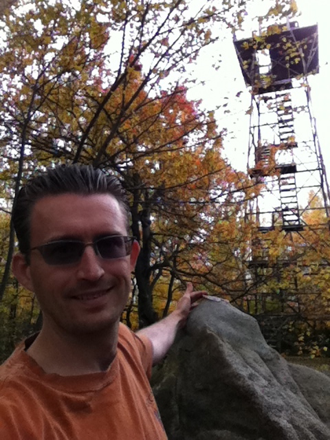
Of course, the tower is man-made so climbing to the top of it is entirely unnecessary.  The true highpoint is actually nearby much closer to the ground.  Indeed, just beyond the tower there are some large boulders.  The largest among them, coming in at shoulder height or so, has a geodetic marker on the top of it.  That’s the highpoint!  I posed for a self-taken photo of me touching the highpoint with the observation tower in the background (see below).  The marker has no sign pointing it out, and it is very easy to miss!  I imagine most of the visitors here climb the tower and completely miss the marker.  It is an openly hidden secret, really.


The Highpoint is on the Largest Rock Straight Ahead


Just beyond the tower and the boulders, there is an extensive series of signs, arranged side by side, talking about the surrounding area and points of interest:   the tar kiln, the Baughman rocks, etc.  One of the signs interestingly points out how the sorted stone pattern at and around the highpoint was entirely due to frost pressure.  That was kind of cool.  Beyond this, there is a very short trail that leads down to a picnic area and another parking lot.  I suppose one could have started there and properly summited via this trail, but it all comes down to which way you are traveling.


The Highpoint Marker


One thing I definitely recommend is traveling down the road from the highpoint a quarter mile or so.  There is a small pull-off there with a very lovely view of “Highpoint Lake” off in the distance.  The views are gorgeous here, making this a fun highpoint to do.         


View of Highpoint Lake


Thursday, October 4, 2012

Highpoint #5: Delaware


Vanity Shot at Delaware's Highpoint Sign


 The highest point in Delaware?  It almost sounds like a joke.  After all, Delaware is known for being both a very small state and a very flat state.  There are no mountains there!   What could possibly even count for a highpoint in Delaware?  The answer, as one might imagine, is less than glamorous:  a hilltop alongside a road.  Yes, the highpoint is not even on a stand-alone hill.  Worse, it is not even clear where the highpoint really is.


Sign for Delaware's Highpoint
So let me go through this.  There is a very prominent sign along the Ebright Road (at it’s azimuth) that declares the highpoint of Delaware with the name “Ebright Azimuth”.  The sign says that the elevation is 447.85 feet high, making it the second lowest highpoint in the United States, falling in just after Florida.  The sign also says that the highpoint is not at the location of the sign, rather it is “in the vicinity”.  This is where it gets confusing.  A stone’s throw away from the sign there is a geodetic marker on the ground, also along the road.  One can easily take this marker as being the true highpoint.  However, it is not unique.  If you follow the direction of the arrow on the marker, it points to another geodetic marker several hundred yards away across the road that leads into a trailer park.  A quick trip over, one can find the second geodetic marker housed prominently in a concrete cylinder just across from a historic house.  Certainly between these two markers and the sign, one should have a true highpoint among the three, right?  Well, not so much.  Apparently there is yet a THIRD marker also in the “vicinity”.  Its location is uncertain, even among people who really worry about such things.  Supposedly it lies on private property and may very well have been built upon in the intervening years.  Wow, what a mess!  Suffice it to say, the true highpoint is not particularly obvious, but it most certainly lies somewhere on the plane above this hilltop.  For the purposes of highpointing, the sign together with the two markers are more than sufficient to claim a successful ascent. 
First Geodetic Marker near Sign

Now, I would never have known so much about this confused history of where the true highpoint lies just by coming across that sign.  I actually had the very good fortune on my visit to have my very own tour guide.  It all happened by accident.  I was just looking for a place to park, so I pulled into the subdivision beside the highpoint sign.  I parked in front of a house, and I started to get my camera, phone, etc.  The lady who lives at the house soon approached me.  I assumed she was just going to tell me to leave, or something to that effect.  In fact, she asked if I was a “highpointer”.  I answered, embarrassingly, that I was.  She introduced herself as Doreen, and soon told my girlfriend and me all about the Ebright Azimuth including the spiel about where the true highpoint actually is.  She graciously walked us over to the sign and the first marker, and she even gave me a lot of literature to read on the highpointer’s association.  Who knew?  Uncommonly friendly and helpful, she really made this molehill as interesting as any mountain.  That was a real treat!


Second Geodetic Marker
Detail of Second Geodetic Marker


Historic House Across from Second Geodetic Marker


References:

Doreen provided me with a lot of reading material.  Some of it is directly available on the web, and part of it was from a book available from Amazon.  Here is what I have:


Interesting article about someone doing 50 peaks in 50 days:


Another article about an ultra-athlete who has done all 50 peaks:


The official organization:


An out-of-print book that serves as a guidebook to each of the state highpoints:


Saturday, September 29, 2012

Highpoint #4: Connecticut


CT Highpoint Marker
Clumsy Vanity Shot


Again I found myself in NYC for a running race, so I decided to take advantage of the opportunity for another highpointing adventure.  Since I went to the NJ highpoint on my last trip, the next closest one was in Connecticut.  I scouted it out on the map, and it looked fairly doable as a day trip being only about three hours drive away from the city.  The trip was on!


Parking Lot Sign
AMC Parking Lot


The Connecticut highpoint is properly the “south slope” of Mt. Frissell, and it is located very close to the geographical point where New York, Connecticut, and Massachusetts all meet (more on that below).  Now, “south slope” is an interesting description.  The thing about highpoints is that they do not always fit the stereotype of being a nice prominent peak visible from a distance.  In the case of Connecticut, it is anything but that.  Indeed, the highpoint marker actually falls on the Connecticut/Massachusetts line, and not on the top of a hill or mountain like one might think.  Indeed, the summit of Mt. Frissell is actually in Massachusetts.  Fortunately, in order to arrive at the highpoint, you do summit a couple of hills along the way if you take the standard route, so the climbing experience is not lost all together. 

I arrived at the trailhead by following East Street on the Massachusetts side and crossing the border into Connecticut where it immediately becomes Mt. Washington Road.  There is a modest parking lot off to the left designated with an “AMC Northwest Parking” sign (see photos above).  I parked here, and just walked back up the road 100 feet or so to the border and made a left into a much smaller parking area.  The trailhead was just beyond there.


Trailhead (Note the Red Blaze)


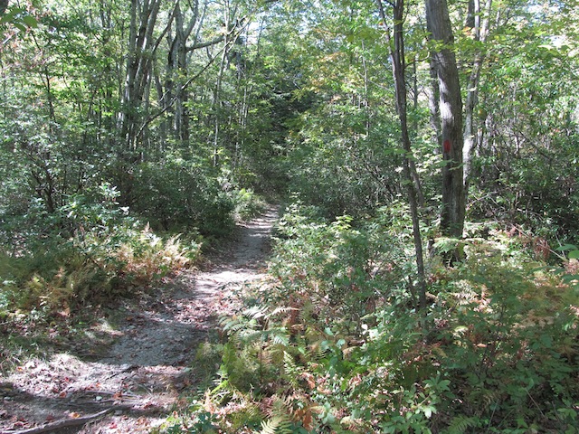
The trail itself is pretty well blazed with red blazes, so it is easy to follow in nice weather.  However, with that said, many of the blazes are on low-lying rocks and not on trees, so they could be missed entirely if snow is present.  Fortunately, it was an absolutely beautiful day when I visited, so I could zone out and enjoy the hike. 


"Wall of Rock"

The hike starts off easily enough on a flat graded trail that eventually leads to a “wall of rock”.  There is nothing difficult about the rock; really, it is just straightforward scrambling requiring hands for support at times.  Exposure runs from non-existent to at most a few feet, so there is nothing harrowing here either.  After this wall of rock, there are a few more like it along the way to similarly pass over.  Summiting the intervening hillocks will have you encountering a couple of rock cairns. 


Rock Cairn


The second “summit” has a bit of a clearing where you can go off in 2 different directions.  To the right, a couple of hundred of feet away, there is a summit register hanging from one of the trees with “2,380 feet” etched into the side, designating the elevation.  This is not the official highpoint, but it is the nearest summit, and it is where many people who are highpointing choose to record their accomplishment.   If you return to the clearing and go in the other direction, you eventually will come across another large rock cairn and a small green cylindrical spike emanating from the ground.  It designates the state line and is considered to be the true highpoint.  It is a little underwhelming after all of the scrambling, but it will do. 


Summit Register


If you push on just a little bit farther beyond this point, there is another goodie awaiting the would-be hiker – a tripoint!  They actually have a fairly nice marker (waist high no less) that marks where the three states come together.  MA and NY are etched prominently on the marker.  CT is missing, but someone has tried to mark it in with chalk.  Essentially Connecticut wishes to have nothing to do with this highpointing or tri-pointing business.  So it goes.  


Tri-Point Marker
Vanity Shot at Tri-Point Marker


Since there is no prominent peak, there is no grand panoramic view anywhere.  Though, there are some great distant views of the land below along the way.  Just a few feet from the green spike, I found this great view:            


Great View!


Overall, this highpoint was a lot of fun and, refreshingly, was more demanding than all of the other highpoints I have been to up to this point.  I wish I had more time to hike on farther to other scenic destinations nearby.  New England is just a great part of the country to spend time outdoors!  

Saturday, September 15, 2012

Highpoint #3: New Jersey

Standing before the Highpoint in New Jersey


Standing in front of the Official Plaque


On the east coast, it can be difficult to put together a road trip just to visit a single highpoint.  The activity is fun and all, but some of the highpoints are just not that compelling, or they are compelling but not worthy of an all-day drive just to see them.   However, if one has a road trip in the works anyway, then it is a pretty easy matter to tack on a nearby highpoint as an additional stop.  This is exactly what I did on Sunday when I drove to NYC to run the Bronx 10-Miler.  Northwest New Jersey was not all that much out of the way on the drive back to Washington, D.C.  Why not make a slight deviation to visit the highpoint there?  It could not have been easier. 


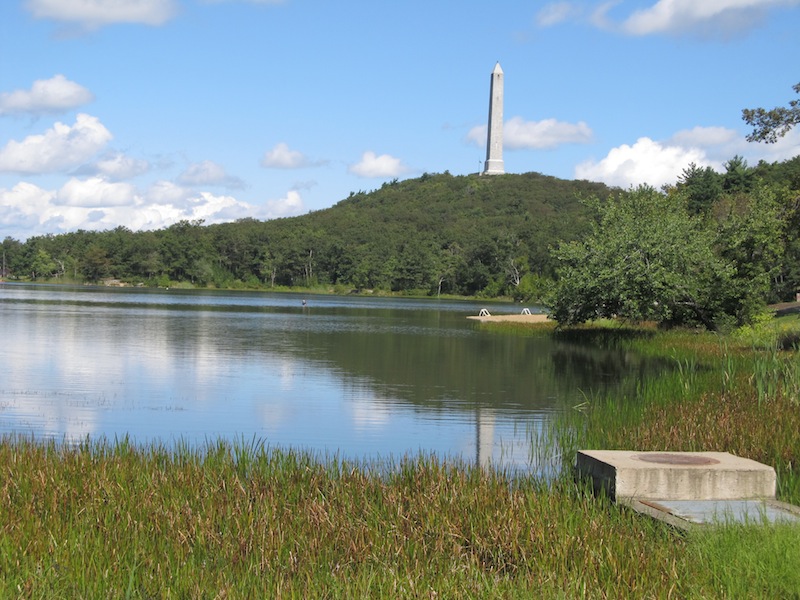
View of the High Point Monument from a Distance


Detailed View of High Point Monument


New Jersey might be the Garden State, but the state does have some mountains.  The Kittatinny mountain range, a subset of the Appalachian mountains, actually runs through the northwest corner of the state.  The highest peak in this range is called “High Point” and has an elevation of 1,803 feet.  Yes, the highpoint is actually called High Point.  To make it easy to visit, I suppose, High Point is located in High Point State Park and has a road to the top.  


The Steps to the Top, Inside of the Monument

The state park is pretty nice.  It stands out among state parks that I have visited, and, if I lived in the area, I would definitely make regular visits here.  The signage is very good to figure out which turns to make to arrive at the summit.  At one point, you will see a lake and a hill in the distance with a very large obelisk-shaped monument on top of it.  That’s the destination.  The road leads all the way up the hill, culminating in a parking lot just short of the monument.  The parking lot affords great views of the peaceful countryside all around.  The push to the summit, if you will, is just a short paved hill easily walkable in a minute or two (see top photo for a good view of the hill). 


View from the Top of the Monument


The monument itself is most impressive!  Seriously, it rises 220 feet above the natural highpoint for the state.  It’s so high, one has to stand by the parking lot to get a picture in frame with it.  Considering that many state highpoints have little more than a small sign or a tiny geodetic marker, New Jersey is especially impressive in making a mountain out of a molehill.  It is for a good cause though.  The monument was erected in 1930 to commemorate those who have fallen in war.  It is a fitting place for a tribute as it stands prominently and sees many visitors. 

View from the Top of the Monument

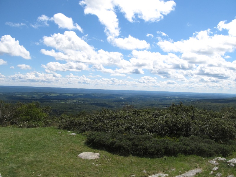
One can, of course, enter the monument and even climb to the top.  For the purpose of highpointing, this is an entirely optional exercise.  The goal is simply to reach the “natural” highpoints in each state.  With that said though, it did not seem fitting to come all this way without trying my hand at “climbing” to the top.  The steps go on for quite awhile, but it is possible to get to the top in less than 5 minutes, if you are reasonably fit.  I had just run a race that morning, so I was more than primed.  At the top deck, there are 4 windows looking outwards in each cardinal direction.  Three of them were obscured by condensation, so that really only left one dramatic view to take in.  Fortunately, it was a good one.  This is a pretty part of the country.  It was great to spend some time to enjoy it.  Upon descending, I spent even more time just soaking up the beauty.  This was not an especially difficult highpoint to get to, but it was a rather nice one.  This would be a great one to do on a motorcycle on a beautiful day.  It’s not a bad place to have a picnic either.  Gorgeous views just abound!  


One of the Many Gorgeous Views!