Sunday, June 9, 2013

Highpoint #24: Vermont


Atop Mt. Mansfield -- Finally!

With summer fast approaching, I was itching to get on the road again.  I strategically waited until the weekend AFTER Memorial day weekend, so I could avoid the traffic and crowds.  My first stop?  Vermont.  I had some unsettled business up there, and I was all too keen to resolve matters. 

See, back in February when I did my highpointing trip for Rhode Island and Massachusetts, I also tried my hand at Vermont.  Yes, February, right after the Nemo storm passed through the area.  There really could not have been more snow on the Mt. Mansfield when I visited then (what was I thinking?).  It ultimately did me in when I approached the final headwall, forcing me to come back another time if I ever wanted to lay claim to the summit.  Well, last Friday was the day!  There wouldn’t be any snowdrifts to swallow me up this time around.  The challenge was on!

I left my place in D.C. first thing in the morning, and I ultimately made it to the Stowe ski resort in upstate Vermont late in the afternoon.  I wanted to take the exact same route that I did in February, so I could see how close I really got to the summit and figure out where I went wrong.  So, for me, that meant taking the Long Trail south and connecting to the Profanity trail, which is a recommended approach in prime winter, when it’s passable anyway. 

Road:  Summer
Road:  Winter


I parked in the small hiker’s lot next to the gate just off the road from the uphill entrance to the ski resort and well before Smuggler’s notch.  The first difference that I noticed was that the gate was open and the road was pristine.  In the winter, that gate is as far as you can get by car as they close the rest of the road until late spring. 

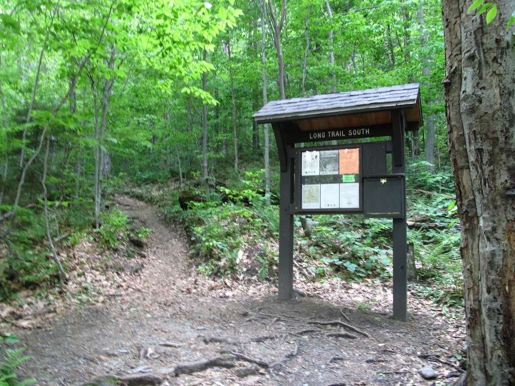
Trailhead:  Winter

Trailhead:  Summer


After a little bit of a walk, I crossed over the road into the woods at the trailhead for Long Trail South.  From there, it is a 1.7 mile hike all uphill to the Taft Lodge.  In the winter, the route was a very popular one with backcountry skiers and the occasional person on snowshoes, like me.  There are plenty of switchbacks, interrupted by a few stream crossings.  In the snow, there was a very clear, smooth path made by skiers in the prior days.  I was able to snowshoe right along that path with no problem at all.  I, thankfully, had heel lifts on my snowshoes which helped with the elevation gain considerably.  In summer though, the path was definitely very rocky and not so smooth.  There were plenty of tiny obstacles to be negotiated, but it was still a pretty straightforward hike. 

It's Easier to Snowshoe...


...Than it is to Hike!


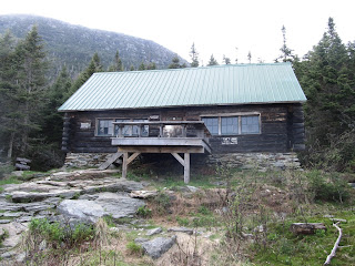
In the winter, the route went direct to the Taft Lodge!  Evidently, skiers are pretty efficient at getting where they need to go.  In the summer, the path meandered and came back around to it, making for a gentler approach. 

Taft Lodge:  Winter
Taft Lodge:  Summer


On both hikes, I opted for the Profanity Trail to go straight up the mountain with less danger of rockfall and exposure.  Look at the signs though from the two trips!  This really tells you how much snow they get here in the winter!!  The smaller sign underneath the main sign was completely covered by snow; I didn’t know it existed!

Sign for Profanity Trail:  Winter

Sign for Profanity Trail:  Summer


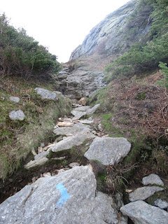
Going up from here was definitely tricky in the winter.  I think most of the skiers just stop at the lodge and either take the moguls down for some good backcountry skiing, or they just wander over to the Chin Clip run at the ski resort and ski down the black diamond route.  Why do I say this?  Because routefinding became quite a bit more difficult after I passed the lodge.  The Profanity Trail is marked with blue blazes, but it seems a little harder to follow, at least initially. 

Profanity Trail, Earlier On


Profanity Trail, Near the End


Last time, I made my own path, and proceeded up the mountain the best I could, but I had enormous difficulty.  Every once in awhile, I would just fall into a snowdrift up to my stomach, and sometimes up to my neck!  These were, I later learned, called “spruce traps”.  They can be kind of dangerous, especially if you are climbing solo.  I eventually had to pull out the ice ax.  With two hands, I plunged it horizontally in front of me, and pulled myself farther up the mountain, again and again.  It was intense.  Ultimately, I reached a spot a bit in front of the headwall that I could not get past.  Everything I tried with my snowshoes, ice ax, grabbing a random spruce branch, or finding an alternative route just failed.  I was stuck!  I eventually had to accept that I was not going to get the summit, and resolved to return another day. 

DEEP Snow!!

To be Continued Another Day!


Well, this time, the story was much better.  The Profanity Trail is MUCH easier to follow when there is no snow.  It also goes a bit to the left of where I was climbing in February.  I clearly was off-route, and when I looked over to it in the summer, I was surprised I could get through any of it at all.  The snow hides a lot!  No, this time the path was narrow and filled with straightforward scrambling.  It did not take long for me to reach the alpine zone. 

Yay!  The Difficult Portion is Over!

From there it is a piece of cake to finish.  Just follow the boarded off trail portion to the true summit.

It's Pretty Easy Going From Here to the Summit!

At the top, the view is incredible.  A 360-degree panoramic field of vision is available to you, allowing for a keen view of Stowe ski valley and points beyond.  I was the last hiker of the day there, so I had the whole place to myself.  It was so beautiful.  I took my usual photos. 

View of Stowe from the Summit
There was a USGS marker to denote the summit, but it looks like it was kind of beat up.   I eventually decided to head down, before the sun beat me to it. 

Vanity Shot at Summit USGS Marker


Detail of Beat Up USGS Marker at Summit


I made great time back to the Taft Lodge, but now it was starting to get dusk.  I was like, “oh I am pretty close to the car now; Just smooth sailing from here.”  Ugh.  Sure enough, I messed up on one of the stream crossings, and kept following the stream instead of the trail.  Rapid current, wet rocks, and darkness made for a treacherous combination.  I kept descending, trying to lose elevation, but there was no sign of the Long Trail or the highway that I walked in on.  Luckily I had a headlamp and GPS, but still this was quickly becoming bad by the minute.  I tried wandering away from the ravine, but it was dense and not yielding me anything useful.  After a good half hour of this, I finally stumbled onto a clearing next to the rapid.  Sure enough, it put me right back on the Long Trail.  I couldn’t believe it!! I signed out at the trailhead, and walked back to my car. 

It’s funny because I also had trouble following the trail back in February on the way down.  I got lost in the moguls and eventually made my way over to Chin Clip and walked down the ski run to the Stowe parking lot.  I am sure ski patrol loved the idea of a guy emerging from the woods onto one of their ski runs holding an ice ax in his hands.  Oh well, so it goes in this highpointing business.  The skiers could not have been friendlier though, with one going so far as to cheer me on.  

View of Mt. Mansfield, by way of Chin Clip, from Stowe Ski Resort Parking Lot

In truth, this mountain was just not going to give up its highpoint easily to me.  I never had so many problems before with such a seemingly simple hike.  Oh well, it’s off the list, and I could not be happier.  Honestly though, this is a beautiful hike anytime of the year.  I am glad it turned me on to a pretty cool ski resort too. 

Are there other ways up the mountain?  Yes, several of varying difficulty.  There is even an auto road that goes up to the lower summit in the summer, but you still have to hike a nontrivial distance from there to the true highpoint, so it’s not exactly a drive-up.  It also feels like cheating, since it is a private (read: expensive toll road) road up the mountain.  There is also a gondola available at the ski resort, but I am not privy to the details.  Good luck though on any approach; you likely will not be disappointed.  Just be careful coming down.  Complacency can lead to adventure rather quickly. 
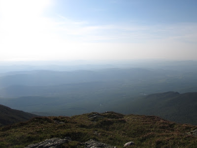

Beautiful Parting Shot from the Summit


Sunday, May 5, 2013

Highpoint #23: Tennessee


Vanity Shot at the Highest Point in Tennessee!


Finishing up Kentucky relatively early in the day, I decided to push on to Tennessee to visit its highest point at Clingmans Dome, just outside of Gatlinburg.  The trip was pretty easy going until I wound up in the vicinity of Gatlinburg; then it was nothing but standstill traffic.  Eventually after a half hour of just sitting around (literally), I learned that the roads were being closed for some sort of funeral procession involving firemen.  After that cleared, I proceeded towards Smoky Mountains National Park only to make a grave error.  Instead of taking the “bypass” route, I opted to pass through Gatlinburg itself.  More standstill traffic awaited me!  Apparently it is set up like the Las Vegas strip there, with businesses all up and down both sides of the road, with tourists walking from side to side all along the way.  It might be a tiny tourist trap town, but it took forever to drive through.  I eventually made it though, and found myself within the perimeter of the national park.  For the would-be highpointer, definitely take the bypass!

I followed the main road up through the mountains.  The road is quite windy and goes on for quite a distance, ultimately connecting to Cherokee, NC.  On my visit though, the road was closed at Newfound Gap due to rock fall occurring during the winter.  

Turn-off for Clingmans Dome Road

Luckily, the turnoff for Clingmans Dome occurs just before Newfound Gap when driving in this direction, so the road closure had no effect on my plans.  Of course, the road to Clingmans Dome itself is also closed during the winter, but they had just opened it up a few days before.  So, really I was all set to just enjoy the views and drive to the top. 

Note:  The Road is Seasonally Closed!

It was quite the drive, too!  Just to get to the turn-off for Clingmans Dome, it was 16 miles of mainly switchbacks.  It was so green and inviting.  The park was definitely the kind of place where one would want to do some extended hiking and camping.  It’s not just me either; Smoky Mountains National Park is actually the most visited national park every year out of all the ones we have!  At the turn-off for the dome, it was still another 7 miles to the parking lot!  The road was in fantastic shape though, so I just kept soaking in the beauty. 

Informative Plaque at the Summit Parking Lot

At the parking lot, there was a very large overlook where you could see for a considerable distance.  Mountains abounded in seemingly every direction.  To continue to the summit, it was all on foot from here.  There was a paved trail, one-half mile in length, extending all the way to the summit.  

Final Stretch:  Half-Mile on Foot!

It was all uphill, of course, so they provided benches all along the way for rest stops.  It’s crazy that a 1-mile, round-trip hike would require them, but I guess it makes the trail accessible to everyone that way.

Paved Trail to the Summit

The hike was a very quick jaunt, and surprisingly well-signed.  

Just in Case You get Lost on the 0.5-Mile Stretch!

The superstructure that is Clingmans Dome quickly came into the view.  

First Glimpse of the Summit

I finally made it the dome itself, and proceeded up the smoothed spiral walkway, reminiscent of the Guggenheim, leading to the main lookout deck.  

Up We Go!

From the top of the deck, I had the best view in all of Tennessee, being able to look out for nearly 100 miles in all 360 degrees of viewing directions.  

Half-way Up

The panoramic view was simply gorgeous!  I appreciated it the best I could, but it did start to get a little busy up there.  I kindly had someone take my photo, and decided to head back down to the base of the dome.  I walked all around the base of the dome, but I was unable to find any geological markers commemorating the highpoint.  

View from the Top!

I know the dome itself is man-made, so while going to the top was fun and informative, the true highpoint lied just beneath it somewhere along that mountaintop.  Between my loop of the structure and my attempting to put my foot on top of what looked like the highest point, I felt comfortable in being able to scratch this one off of the list. 

View from the Dome of the True Summit Below

I strolled back down to the parking lot and took another good look out over the distance, before ultimately deciding to head down the mountain for good.  

Equally Impressive Views Can be had from the Parking Lot!

Now the true challenge of the day was before me.  I had left at 4:30am from Washington D.C. and had just visited the highpoints in Kentucky and Tennessee.  It was early evening.  Could I push all the way back to D.C. in the same day?  I decided to go for it.  Believe it or not, I actually made it!  After an unhealthy number of Red Bulls (seriously), I pulled into the garage of my building at 2:30am.  I did the whole trip in a mere 22 hours.  I managed a total of 1160.7 miles of driving all in the same day (defined as a 24-hour period).  That is a new 1-day driving record for me – yay!  To be a good highpointer, it probably helps to have an obsessive personality.  J

Proof of 1-Day Mileage!


Sunday, April 14, 2013

Highpoint #22: Kentucky


Kentucky! 

Well, I was in the mood again for another highpointing trip.  It had been over a month since I last hit the road, and two nearby states were sticking out on the map like a pair of sore thumbs:  Kentucky and Tennessee.  These are the last 2 southern states for me, and I had yet to visit their highpoints.  The highpoint in Kentucky is a drive-up as is the highpoint in Tennessee, most of the year.  The road to the top of Clingman’s Dome in Tennessee just opened up for the season according to the Smoky Mountains National Park website, so this was good of a time, as any.  I opted to do both – IN THE SAME DAY!  Nearly 1200 miles of solo driving, out and back… could it be done? 

I left my place in D.C. at 4:30am to get an early Saturday morning start on I-66 and eventually I-81.  The latter interstate continued interminably towards Tennessee.  It is amazing how big Virginia actually is.  Luckily, the southwestern corner of the state is really gorgeous.  There were mountains everywhere, and the views were beautiful.  I eventually made my way up to Appalachia, VA and took 160 into KY. 

You have to look quickly though, the turnoff to the highpoint of KY is right between the “Virginia Welcomes You” sign and the “Welcome to Kentucky” sign.  I always thought the space between state lines was “no man’s land”, but apparently, here, it is all Kentucky. 

Turnoff to Highpoint is Literally Next to the VA Border

Fortunately, there are road signs in each direction saying “Crossing Black Mtn. / Highest Point in KY”, so there is some indication that you are close to the summit. 

Sign for Black Mountain:  Are those BB Shots?

The turnoff is a road of mixed character.  It was at times muddy, at times paved?, and at the end, graveled. 

Road to the Highpoint

It’s narrow though, so allowing oncoming traffic to pass requires some coordination.  It goes on for longer than I would have guessed, considering that I was already pretty much at elevation.  I passed the FAA Long Range Radar Dome on the way and eventually pulled in behind a school bus parked before the final stretch leading to the summit. 

Sign En Route


FAA Long Range Radar Dome


The school bus belonged to Mountain Alliance, which, I gathered, was some sort of outreach organization getting kids to explore the outdoors.  I walked the final hill to the summit with one of the guides.

Final Stretch to the Summit

Seeing my Washington D.C. license plate, he asked if I really drove all the way in from D.C. for this?  To which I responded with a lame, “yes”.  This will make more sense one day when I go to climb Denali, as these highpoints all fit together.  Individually though, some of them are definitely met with their share of skepticism.  I opted to not further embarrass myself, by not asking him to take a photo of me at the summit.  So it goes.    

The Summit of Black Mountain!

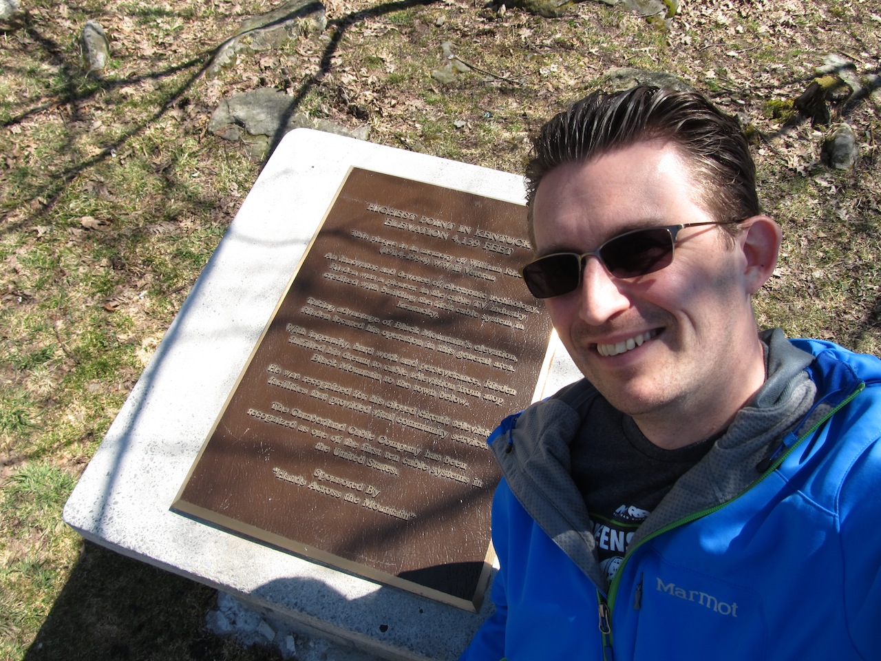
Walking around the summit, there was not a whole lot to see.  While the view by the turnoff was dramatic and extending into the distance, the view from the summit was virtually nonexistent.  Around the summit, there were a few points of interest though.  The obvious one was the actual summit plaque, which marked the highpoint and gave a short history on the area.  

Summit Plaque and Monument 


Vanity Shot in front of Summit Plaque


Additionally, there was a fire tower that was centrally located on the hilltop.  

Fire Tower at Summit


Detail of Fire Tower

Underneath it, I was able to find a USGS marker with the triangle symbol.

USGS Marker Beneath Fire Tower
Strangely, there is some dispute as to whether the highpoint is indeed underneath the fire tower.  This is said because, nearby, there is a large summit rock with another USGS marker.  That marker is the benchmark marker, and it does have a specific elevation recorded on it. 

Summit Rock

USGS Bench Mark with Elevation

The latter marker apparently sets about 6 feet lower than the former marker.  It could be the true highpoint if the mound under the tower is manmade.  I am not sure which is the true highpoint, but I made sure to visit both and take vanity shots just to cover my bases. 

Vanity Shot on Summit Rock
Vanity Shot at Fire Tower

I made a final loop around the summit area and then descended down the hill back to my car.  I drove down to the entrance and parked by the overlook.  This was really the best part.  The view was incredible here!  It was lunchtime, but I didn’t have the forethought to bring my lunch here.  It would have been a great spot to spend some time and soak in the beauty.  Oh well, if I was going to visit the highpoint in Tennessee and make it back home all in the same day, I had better get going…

View from the Overlook! 

Note before you go:  the highpoint is on private property, so a signed waiver agreement is needed either on your person or sent in beforehand.  A current copy of the agreement can be found here: