 |
| The Highest Point in Nevada! |
Only a month ago I set out on a long (4000+ miles) road trip
to the upper Midwest to gain five new highpoints. Apparently, I felt enough time had lapsed as
I was once again in search of more highpoints.
Having completed all of the states east of the Rocky Mountains, it was
now time to start booking flights. I
traded in some of my airline miles for a sweet set of roundtrip tickets to Las
Vegas. Indeed, the next highpoint I had
in mind to tackle was Nevada!
Airline miles are much more difficult to use these days
though, so it was pretty difficult to find days, times, and even airports that
made sense for what I wanted to do.
There was not a single free flight to Reno for the entire month of
August, for example. All I could find
was a Monday night flight to Vegas, and even then only first class seats were
all that was available costing me twice as many miles. Ugh!
The flight endured a pretty raucous storm and put me into Vegas at
around 10:30pm local time. From there, I
proceeded to drive my rental car northward into the desert all through the
night arriving at the turn off road for Boundary Peak around 3am.
 |
Turn-Off for Mining Road (and Trailhead)
|
This was the most sensible place to stop as it was another
15 miles off-road on a rough mining road to the Trail Canyon trailhead with the
occasional steep drop-off along the way.
These are the sort of driving conditions I am reluctant to endure during
the day, and certainly would not think of doing in the dark cover of
night. So, I decided to take a nap in my
car until dawn approached.
 |
| Nevada is Kind of Pretty at Dawn |
 |
| Boundary Peak is Faintly Visible in the Background |
As I sensed the sun coming up, I properly woke up and began
the drive to the trailhead. Fortunately,
on my visit the road had not seen any recent rain. This made for much smoother passage with no
streams to cross. Apparently during
inclement weather, the conditions can be quite a bit worse, with the road not
even recommended for use.
 |
| "Travel Not Advised During Inclement Weather" -- Good to Know! |
The road was minimally signed, but I was relying on detailed
turn-by-turn directions that I found attached to someone’s trip report online,
so it was not too difficult to figure out which way to go at the different
intersections. Really the focus was just
on driving slow enough to accommodate the occasional large rock on the
road. For the most part though, the road
was graded and simply gravelly, so it was not the ordeal that I was led to
believe it would be. My rental car, a
Chevy Impala, easily negotiated the terrain.
The only issue I encountered the whole time was some scrub brush
extending into the roadway area near the top which could have led to scraping
of the car, if I wasn’t careful.
 |
| The Only Indication that You are at a Trailhead |
 |
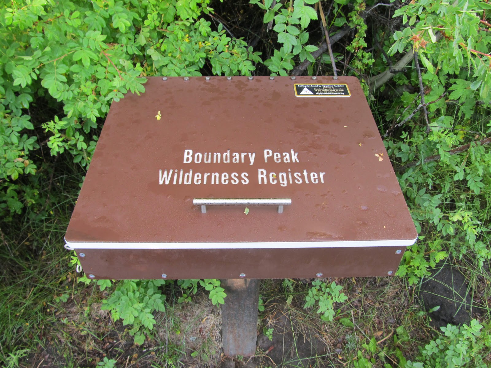
| The Trailhead |
The trailhead doubled as cow pasture, but there was a formal
kiosk and trail register so there was no mistaking it. The kiosk warned of bears and advised taking
the usual precautions with regards to food.
After a quick signature at the register, I was off.
 |
| Let's Do It! |
 |
| This Trail Will Soon Disappear |
The obvious path leading away from the trail register,
quickly became a user path, then a herd path, and then disappeared altogether
from view. The direction was clear
however; keep heading uphill through the canyon advancing ever closer towards
the highest mountain in sight. I dashed
from one herd path to another, working my way around lots of mountain mahogany
scrub and through large thickets.
 |
| Left or Right? (Note the Large Boulder) |
I soon put the vegetation zone behind me. Ahead lay two potential paths. To the right, I could continue along this
same line and make my way for a low-lying ridge. From there I would have to hike up a steep
slope to gain the summit ridge and proceed to traipse along it until I arrived
at the summit of Boundary Peak. To the
left, I could make my way into a cirque, have a very steep climb to the summit
ridge, and make a quick dash over to the summit. At least, that was how everything looked to
the eyes of the beholder down in the valley.
I think the standard approach is to go right, with a less popular
variation being to go left. Not knowing
this, I went left hoping for a very direct route.
 |
| Deceptively Easy |
I was encouraged by a prominent path, mostly sandy, leading
deep into the cirque. I was less
encouraged by the rocks strewn about everywhere as I was clearly proceeding
along the fall line for this mountain. The
summit ridge in the distance looked like it would be very easy to gain. I clearly did not realize how deceptive
elevation can be out in the desert. What
in fact lay ahead for me was 3000 feet of elevation gain through scree and
talus. Oh what a torture this was going
to be!
 |
| Slowly Progressing |
I proceeded in a straight line right through the middle of
the cirque making it about half way up.
The sections were gradually becoming steeper, and the scree was becoming
deeper. There was lots of unstable rock
as well. I opted to start making my way
to the left to try to make it for a lower ridge line that would connect to the
summit ridge. In part, I was encouraged
by the much larger sized rocks that had a better chance of holding my weight
without slipping into the sandy scree. I
did my best to hop rocks and use my trekking poles for added points of
support. Progress was significantly
slowed, but I ultimately made it over to that ridge.
 |
| Lower (South) Ridge |
From the ridge I had a giant block of rocks and boulders ahead
of me. I hoped none of them would
dislodge or it could very well have been the end for me given their massive
size.
 |
| First Obstacle of the Day |
I descended some on the opposite
side of the ridge and worked my way around the rock obstacle with steady Class
II/III climbing. I eventually made my
way around it and continued to proceed up the ridge more until it connected
with the summit ridge.
 |
| Yay -- The Summit Ridge! |
I was just about
to give myself a pat on the back for the extended effort, sensing the summit to
only be hundreds of feet away. As I made
my way further up, all the way to what I perceived to be the top, I realized
that the point I had been hiking towards for the last few hours was a false
summit. Indeed, yet another rising mound
lay ahead of me along the ever continuing summit ridge. Additionally, there would be more large rocks
to climb around. Great!
 |
| Still Not There Yet! |
The drudgery aside, I was actually pretty encouraged. From this new vantage point, it was pretty
clear that I was now heading towards the true summit. I made my way through the last steps and
closed in upon the summit area. There
was a semicircular wind break made from rocks with a small American flag
protruding out above it. Tucked inside
the rock formation, there was an ammo box containing the summit register.
 |
| The Summit! |
First things first, I made my way over to a nearby rock
which was emblazoned with the USGS boundary marker marking the true
summit.
 |
Vanity Shot at USGS Boundary Marker
|
 |
| Detail of USGS Boundary Marker (The True Summit) |
After a quick vanity shot, I opted to dig into the box with
the summit register. There was a Nevada
state flag, a few trinkets, and a wire-bound notebook. I inked an entry marking my 39th
highpoint – yay!
 |
| Apparently, This is a "Good Recovery Hike after Climbing Half Dome"! |
I took photos of the magnificent views and took some time to
soak it all in. There was no wind at
all; the weather was beautiful; and it was still plenty early in the day! I tarried a little bit more than usual as a
result. I was just impressed with the
expanse that the low-lying desert afforded.
This is definitely a part of the country I would never have seen if it
were not for highpointing.
 |
| The Landscape Seems Other-Worldly at Times |
After a little bit of time, I prepared for the descent.
 |
| Now Just Head Straight Down! |
The scrambling was pretty straightforward,
but once I descended below the ridgeline it was back to the ever giving
scree. Basically, it was just one slow, controlled
slide until I could make my way down to the canyon area.
 |
| Keep Going Down! |
Interestingly enough, the canyon ended up
being tricky to navigate. I had no luck
in finding any well-defined trail back to the trailhead. I knew of course to keep heading down and the
canyon walls bounded how far laterally that I could move, but once I got into
the thickets I could not find a good route.
I was dodging branches and cow patties everywhere, hopping creeks, and
even dodging cattle! This was
ridiculous! At one point, I thought I
was actually lost. Sure enough though, at
that point I was a mere 20 feet away from the trailhead register. Wow! I
made my way out to where I parked my car, following a few straggling cows. I wrangled them onward towards the water, and
got back into my car. I guess I missed
my calling as a rancher!
 |
| Parting View of Boundary Peak from the Highway |
From here, I was off to Mt. Shasta to treat myself to a good
glacier climb via the Hotlum glacier route.
After that, the highest point in California was on the slate: Mt. Whitney.


