 |
| View Across the Crater from Columbia Crest, the Highest Point in Washington! |
My cross-country road trip was in full swing at this
point. Having left Virginia, I already
managed to climb the highest mountains in Colorado and Utah, and now I was on
my way to Seattle. That being said, my
climb of Mt. Rainier, the highest point in Washington, was scheduled as a
guided climb. Since the dates for the
climb were fixed nearly a year in advance, running ahead of schedule, as I now
was, meant that I would simply have to wait until the appointed date. This was not too problematic though since I
was in one of the most scenic parts of the country to have some downtime.
I managed to camp out in Glacier National Park and see what
few glaciers still remain there. I then
continued on to Mt. Rainier to have an advance look at the mountain and the
climbing route. After taking in the views
of one of the most beautiful stratovolcanoes in the world on one of the fairest days, I spent the night at Whittaker’s Bunkhouse just down the road
from Paradise. Whittaker’s was of course
RMI territory (the original and most well-known guiding service for Mt.
Rainier), so I could not resist experiencing a part of mountaineering history
by visiting there and having a Rainier beer served by none other than Peter
Whittaker himself. The day was an
inspiring one!
 |
| The Objective: Mt. Rainier! |
Driving into Seattle the next morning meant that I managed
to drive my car all the way across the country – yay! First order of business was visiting Alpine
Ascents (my guiding company for the trip) and doing a required gear check. This was a straightforward affair and went
pretty easily, since we all had previous mountaineering experience. It was a good chance to meet the other
climbers though.
Our chosen route up Mt. Rainier for this expedition was the
Kautz route. It is a more involved,
intermediate level route that involves a little bit of ice climbing as part of
the summit bid. It is definitely not a
route for the uninitiated. Indeed, all
the beginners typically go up the comparatively easier Disappointment Cleaver
route (also located on the south side) or sometimes the Emmons route, which is
on the north side of the mountain. Being
a more demanding climb, everyone at the gear check was already pretty experienced. Some had summited Rainier before by one of
these other routes, some climbed Mt. Baker and had completed mountaineering
school, and others had varied climbing experience in the Cascades and beyond. One had even climbed Denali (the highest
point in Alaska)! My experience was an
8-day mountaineering school that I did with Alpine Ascents two years ago on Mt.
Rainier over on the Winthrop glacier.
Additionally, I soloed Mt. Hood and had done a few other mountaineering
climbs, so this was the next logical step in my climbing career.
After the gear check, I went over to my AirBnB apartment
along the waterfront to check in for the night, a new first for me. My host was absent, but I was able to still
get into the apartment eventually. I
deposited my bag, went out for some sightseeing and dinner, and came back later
in the evening. Later back in the
apartment I met up with the host, talked a bit, and called it an early night
since I had to be up first thing in the morning.
I “checked out” of my AirBnB
apartment at 5:30am and began walking over to the Alpine Ascents office located
about a mile away. I had plenty of time
to make the 6am rendezvous, so I enjoyed a pleasant walk in the cool morning
air. When I arrived, I saw several of
the other climbers in line in front of the door. Apparently, no one with keys to the building
had yet arrived. After about 10 minutes,
one of the Alpine Ascents staff arrived and let everyone in. We quickly claimed our bags and brought them
out to the mobile trailer, making sure to separate out all of the sharps (ice
axes, crampons, etc.). We loaded up
rather quickly and made our way out of Seattle.
The ride to Ashford was quiet and
scenic. We had a view of Mt. Rainier for
most of the trip in, which afforded us ever more striking views of the volcano
as our distance to it narrowed. Our
progress was zippy and contrasted rather well with the standing traffic trying
to make its way into Seattle. Once we
pulled into Ashford, we stopped at Whittaker’s.
Hey, I know this place! I had no
idea that Alpine Ascents got on well with RMI; it was good to see this
camaraderie between competing guiding companies. Better yet, I was in for a decent breakfast
before starting the climb. Red-eye
coffee and an egg, ham, and cheese bagel?
Yes, please.
After breakfast, we assembled
again and made our way into the national park.
We were all issued our individual climbing passes (good for the
entire calendar year), and we proceeded up to the visitors' center in Paradise.
 |
| Good for the Entire Year! Wish I Lived Here! |
Now it was time to get down to
business! I changed out of my street
clothes and into my climbing clothes and set aside some fresh clothes in the
van to change into for the return trip back.
I gathered my share of group gear (food, fuel, and pickets) and half of
a tent, and repacked my backpack.
Waiting around for everyone to finish and get started, I took some
pictures.
 |
| Alpine Ascents Van and Trailer and Two Guys with Icy Stares Blocking the Shot |
Some visitors to the park stopped
by and talked to us about the climb. One
lady asked if she could lift my backpack to get a sense of what we had to
carry. With the pack weighing in at more
than 60 pounds, she was unable to lift it off the ground. She took in a clear view of the summit and
then turned back towards us, laughed, and dismissed us as “crazy”. That was a seemingly fair assessment of what
we were about to do.
 |
| Van Parked and Getting Ready to Rock |
Now it was go time! For the next 4 days we would be on the
mountain. We were 12 in all which broke
down to 8 climbers and 4 guides. We proceeded
up the steps, emblazoned with John Muir’s words, more or less in line-file and
followed the paved path up and away.
 |
| John Muir Endorses this Climb |
Soon the tourists thinned out and
then all but disappeared. We made our
way over to Glacier Vista where we searched for the best place to descend onto
the Nisqually glacier. We worked our way
down a rocky cliff keeping to a largely class 2 route.
 |
| Off the Paved Trails, Approaching the Nisqually Glacier |
Once we were down to the glacier proper, we
took out our climbing harnesses and roped up in teams of three. Of the four guides, I, by chance, wound up
with the most famous one: Lakpa
Sherpa. Seriously, he has -- summited -- Mt.
Everest 17 times and has his own clothing line.
He is the mountaineering equivalent of a rock star. I clearly was in very capable hands tied into
his rope. Of course, the initial terrain
hardly merited someone of such stature to guide me through it, being relatively
straightforward and all, but it was an honor nonetheless to have that
experience.
 |
| Roping up with Lakpa Sherpa |
The glacier was thinner at this
lower elevation and was interrupted by moraines as we crossed it. As we started to gain altitude along the
glacier, we could see crevasses and began crossing snow bridges.
 |
| Typical Terrain Along the Way |
We made our way over to the Wilson glacier
and made our way up one snowy hill after another.
 |
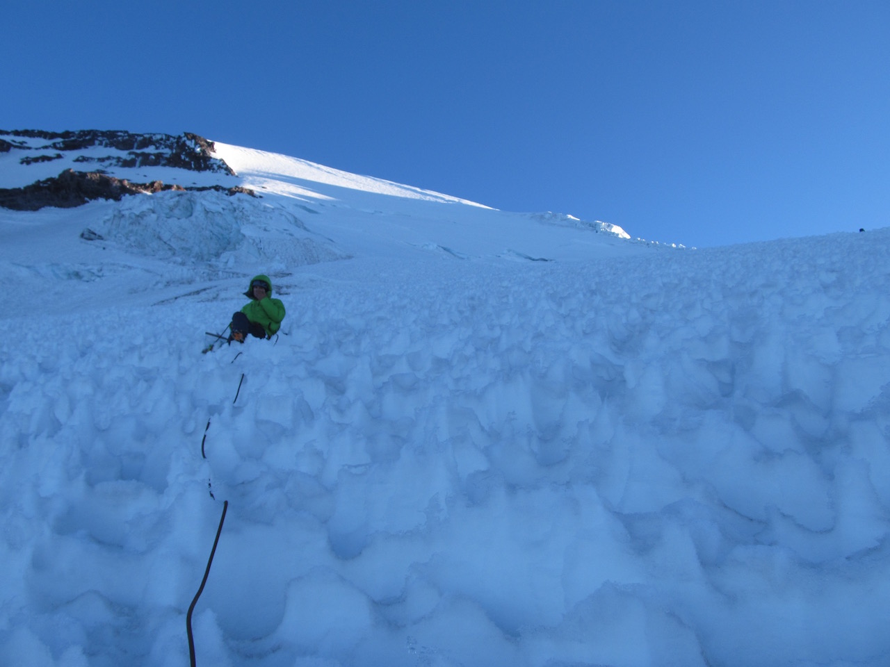
| One of Our Breaks Along the Way |
A few hours later, we walked into camp. It was a relatively nondescript place and one
could easily miss it, but had the advantages of a large flat area to set up
tents and a cleaver like formation that served as a windbreak.
 |
| First Campsite; Mt. Adams in the Distance |
We established camp, and the guides made us
dinner and hot drinks and served us Oreos for dessert. The guides were always good about getting
snow and melting it down for water and refilling our water bottles. As climbers, we got to sit out these
activities and just enjoy the views – definitely easier going than the
mountaineering school where we were expected to be entirely self-sufficient! It was a solid first day, and we were all
good for the wear.
 |
| Set Up Camp with View of Mt. Adams in the Distance |
The next morning we woke early to
hot drinks and breakfast. We packed up
camp with the objective of proceeding towards the icefall visible off in the
distance at around 11,000 feet in elevation.
The icefall always seemed relatively close, but we still had to make our
way up one long hill after another, zigzagging our way up, kicking steps, and
taking rest steps. With heavy packs, it
was a slow-going affair. Again I was
tied in with Lakpa Sherpa, and we were the lead team heading up. Our moderate, purposeful pace was uniformly
kept across all of the teams.
The improving views informed us of
our progress. Along the way we stopped
to allow a team to descend by way of our path.
Apparently, the IMG team had summited just the day before and was
heading down. Our guides conferred with
their lead guide for beta on the route.
We were in for 4 pitches of easy to moderate ice climbing and large
‘penitentes’ (suncups) along the upper route.
While the Kautz route is never quite the same route twice, the scouting
report indicated that everything was going to be straightforward and within
expectation.
We continued up more hills and
finally arrived at our second camp, a bit below the icefall. Evidently there was a party already camped at
the higher spot, so we settled for a lower camp. This was fine by me really, as there is no
need to carry a heavy pack any higher than is necessary.
The downside to the lower campsite
was the narrow shelf within which we had to pitch all of our not-so-narrow
tents. My climbing partner and I got
dibs on the worst spot, so we were in for quite a bit of work trying to remove
rocks and widen the area enough for a tent platform. Fortunately some of the groups of three
finished early and helped our group of two towards that end. We made up camp for the night and had a group
review with two of the guides. We made slings
with our accessory cord that we would clip into anchors along the ice route the
next morning. We discussed rope
management and reviewed expectations for the upcoming summit bid.
Afterwards, we broke up and waited for
dinner. Bangers and Mash! This hearty fare really hit the spot and was
calorically dense enough to fuel our summit bid which was only hours away
now. Indeed, we were told to go to sleep
early. Our lead guide would come around
to the tents and wake us up at around 1am for an alpine start.
I checked in with my tent-mate who
was not feeling so well by this point. In
fact, he felt quite awful. His best
efforts to treat his symptoms were to no avail.
He decided to sit out the summit climb.
I encouraged him to get some rest and see how he felt at the appointed
hour to leave. He obliged, but in the
end though, he did opt to stay behind.
It was 1am in seemingly no time at
all. Up and at it! We had our hot drinks and breakfast and
dressed for the climb. Our packs were
considerably lighter, in the 20-30 pound range, and they felt even lighter than
that given the excitement for the summit bid.
Since my tent-mate stayed behind, Lakpa Sherpa stayed behind with him to
mind him during our absence. Given that,
this time I roped in with our official lead guide for the trip, Brent
Langlinais, who led the first team out. (Technically all 4 of the guides were of lead
guide status, but he was designated the lead guide for this trip on
paper).
We made our way up to the icefall
and over to a narrow edge with a down climb.
There was an emplaced fixed line, which seemed superfluous since the down
climb was, while awkward due to a jutting rock formation to work around, pretty
easy going otherwise. We had to wait for
a team ahead of us to descend. Once we
descended, we made our way over to the Kautz ice route and anchored in. We were in for a traffic jam. There were at least three other teams already
on the route. This is the busiest the
guides had ever seen the route. Indeed,
this route sees very little traffic in general and is known for being a much
quieter way to summit. Go figure.
 |
| The Easier Ice Climbing After the Sun Came Up |
We waited for the teams to
advance, which took a while since they were not so swift in their
movement. Worse, they kicked the
occasional ice down the route. Brent was
annoyed, not being a man who likes to wait.
We did get our turn to go up though.
We made our own line up the right-hand side of the route. The first pitch proved to be the crux with
jutting, bulbous ice to work up and over.
We made pretty good time and anchored in for the second pitch. It was fairly dark out, but we could see the
Milky Way in the night sky amidst a brilliant star field. Even the nighttime views are incredible here! The second pitch petered out about half way
through, and we found ourselves on a flat section thereafter.
 |
| Making Good Progress! |
Crossing this football field of sorts, we
anchored in for the third pitch. At this
point, the sun began to rise. We could
see the mighty shadow that all of Mt. Rainier was casting well off into the
distance. The scale was grand!
 |
| Mt. Rainier's Shadow |
The fourth pitch was more a formality than
anything. There was less ice and more
suncups. They were very large and always
provided a good footing amid the gaps between them.
 |
| Suncups Eventually Dominated |
All in all, the climbing through these
pitches was engaging and never particularly difficult. I did manage to take a whack of ice to the
helmet though that someone climbing above had kicked down, so it is smart to
wear a helmet and anchor in between pitches.
 |
| Ice Route Finished, Normal Climbing Now |
Having completed the ice climbing,
we were back to our routine glacier travel.
Again, it was a series of snowy hills connected by snow bridges, with
the occasional gaping crevasse on display for full view.
 |
| One of the Sections that We Crossed |
After a while, we found ourselves approaching
the crater rim.
 |
| Almost at the Crater Now |
At this point, we took a
short cut that went straight up to the rim over a particularly narrow snow
bridge rather than proceeding up and around.
The bridge held, and we had made it to the top! All 11 of us!
Sort of.
 |
| The Crater Rim! |
Some people consider making it to
the crater rim as a successful summit.
In fact, some guiding companies will only go as far as the crater rim,
saying that there usually isn’t enough time to make it to the highest point. (I chose Alpine Ascents specifically to avoid
this problem). Geographically, the
entire crater rim is not at the same elevation.
Some parts of the rim are higher than others. The highest point along the rim is called
“Columbia Crest”, a point which lay diametrically opposite (and higher) from where
we had “summited”. Being a blog about
climbing to the highest point in every state, where we had summited was
insufficient. No worries though. Our guide was well aware of the distinction
and fully intended to take us over to Columbia Crest, though he did allow that
the trek across the crater was entirely optional.
We did just that. Unroped, we traipsed across the crater itself,
which amounted to a fun walk in the snow, albeit in excess of 14,400 feet in
altitude. At the other side, there was a
very slight hill to climb. We made it to
the top and officially were standing at the highest point in Washington
state! Yay! My 45th state highpoint!
 |
| View from the Top! |
We lingered for a bit and took some
photos. Brent asked if anyone was
interested in signing the summit register located a little farther down, but no
one was particularly in the mood; me included.
Alpine Ascents submits the names of all the successful climbers anyway
to the National Park Service, so it is really just a formality.
 |
| Vanity Shot from the True Summit (Liberty Cap in Background) |
After everyone had their time at
Columbia Crest, we crossed back over the crater rim and roped up again for the
descent down. This was fairly fast going
for a bit. We quickly dispensed with
hills and crossed snow bridges in no time at all. That is to say until we reached the ice
field. Those 4 pitches could not be
descended in a hurry. In fact, it took
forever. The approach agreed to by the
guides was to lower us, team by team down each pitch. This was a very time-consuming process, all
the more apparent being the first team to descend and having to wait for
everyone else to catch up. Easily a
couple of hours had passed to get through those 4 pitches. During one of our pauses, an entire slab of
ice from the adjacent, overhanging icefall had fallen causing a crashing
boom. Yikes! This was not the safest place on the mountain
to tarry, especially with the sun rising and the snow softening.
 |
| Ice Cliff that We Paralleled in the Morning Would Prove Dangerous in the Afternoon |
If Brent was annoyed having to
wait for his chance to ascend, he was definitely annoyed wasting so much time
descending. He was noticeably
agitated. He even had to change up his
plans by descending first rather than last so as to build a v-thread anchor for
us in order to safely descend the final pitch.
Once we all descended, we proceeded over to the fixed line and made our
way up. This should have been
straightforward. Alas, Brent started
yelling and swearing at me that I was stepping on the rope. I continued forward as I could clearly see
that my foot was not on the fixed rope.
Much to my chagrin, my foot was on the climbing rope though. I failed to note which rope he was referring
to during his yelling which resulted in more yelling. Yes, a long day left our guide a wee bit
agitated.
At any rate, we were safe now only
a few hundred yards from camp. We made
our way down, dropped our packs, and changed into more comfortable
clothes. Lakpa made everyone Ramen noodles
which helped us rehydrate. After lunch,
we all turned in for an afternoon nap.
That hit the spot. We woke up,
prepared dinner, and retired again for the night. Brent was considering moving our camp lower,
but there was seemingly a lack of concurrence among the other guides for this
option. I am not sure what the point
would be either. Breaking camp and
setting up camp again is a fairly time-consuming process, and heading entirely
downhill on the last day means it would only save us an hour or so in net time
expended.
 |
| Breaking Camp on the Final Day |
On the fourth and last day, we had
our breakfast and hot drinks and broke up camp.
Descending was fast and easy. We
made our way down one slope after another with the surrounding terrain whizzing
by. Again I was tied in with Brent for
this leg of the trip. What I had chalked
up to agitation the day before was more pronounced on this day. I sensed that his remarks were more pointed
and directed at me. For example, when I
remarked that the lower portion of the Wilson glacier looked a little bit
different to me than it did on the way up, he went off in a monologue about
having good mountain sense, the importance of always looking around, etc. It was just an offhand remark, almost
rhetorical. Really, this merited a
lecture? When we had finally crossed the
Nisqually and were getting ready to un-rope, Brent took the opportunity to yell
at me in front of everyone that I was “again” standing on the rope. Something was off with this guy. So when we had the chance to continue down on
our own accord, I quickly broke away from Brent and tried to catch up with some
of the guys who started up the cliff.
Under the rules of the concession,
you still had to be within eyesight of a guide, even though we were off the
glacier at this point and simply hiking.
So I followed another guide’s lead, Matthew Nightengale. Rather than going straight up the cliff we
had originally descended, we decided to follow along the cliff farther down
into the valley. We apparently were
following a “new” route (later termed the 'Lakpa Direct') that Lakpa was taking his lead group along. The route was very scenic, but there were two
downsides. One, Matthew did not know the
route, so he was always attempting to infer the route which led us to
backtracking a few times. Two, the route
had us crossing fields of wildflowers.
We trampled them one after the other, which was heartbreaking. Indeed, one of the visitors to the park
scolded our group about this reprehensible undertaking. So much for leaving no trace. Eventually we made it back up the paved
trails. We walked around throngs of
tourists and made our way back to the visitors' center.
Ah, civilization! It felt really nice to change into clean
clothes and grab some rehydrating drinks at the visitors’ center. We left the park and went once again back to
Whittaker’s for a post-summit beers and burgers gathering. I grabbed my beer and started heading out to
the main field where all of the picnic tables were. Brent was coming in and told me to go ahead
and grab a table. I found a nice one,
away and in the shade and waited for my lunch order to be brought out. No one joined me; not noticing me, they all opted instead to sit at the main table by the kitchen. Brent came over to my table and
asked if I directed them to sit there?
Huh? He explained that that table
was the summit table reserved for RMI climbers returning from expeditions. He got the okay from Peter Whittaker that it
was okay for our group to sit there though since RMI did not have any climbers
returning that day. Really, he wanted to
know if I orchestrated this? I was
clearly sitting more than 200 yards away from said table all by myself. I declined his offer to join them opting to
“celebrate” alone. I could explain away
some of his personality irregularities as part of the climbing experience, but
this was ridiculous. At this point, I
had enough interaction with Brent to conclude that he was just an asshole who
felt some need to focus his exasperation on me.
Eventually we all gathered together again and drove back to
Seattle. Whew, glad that was over!
As soon as I arrived back, I
turned in my rental items (avalanche transceiver and ice tool), and asked for
the nearest emergency clinic. My right
ring finger was badly infected and was cherry red by this point! There was a clinic a few blocks away, so I
asked if I could leave my bags while I went over to get treated. The gear manager obliged, and I went over for
a long wait at the clinic. The physician
assistant performed surgery on my finger, drained it, and put me on an
antibiotic. Wow, of all the climbing
injuries one could get, I would not have guessed this one!
 |
| Infected Finger. Really? |
I hurried back to Alpine Ascents and gathered
my bags. Nick Mullan, the fourth guide, was
kind enough to carry my backpack to the street. What a nice guy!
The staff called a taxi for me, but the taxi never came. The office had since closed, and my phone was
dead. Ugh. I had to walk a mile with two backpacks to
the parking garage. Oh what fun that
was! Oh well, one of the hardest climbs
was in the books. Time to head to Idaho!
Addendum: I am generally fine with using Alpine
Ascents, and I do recommend them. In
fact, I have since signed up for their Volcanoes of Ecuador trip. Just be careful about who your guides are,
and be prepared to adjust accordingly.
In any business, you are bound to encounter an asshole or at least
someone who rubs you the wrong way. So
goes it; no need to take away from the bigger things that you are trying to
accomplish in life.


