Tuesday, December 25, 2012

Highpoint #9: South Carolina

Cross-Country Highpointing Trip, Stop #2


Vanity Shot at the Summit of Sassafras Mountain


After a successful summit of Mt. Mitchell in North Carolina, I was off to Sassafras Mountain in South Carolina.  The drive in was pretty circuitous owing both to the partial closure of the Blue Ridge Parkway immediately west of Mt. Mitchell and the genuine remoteness of Sassafras Mountain.  Indeed, off the interstate, the roads quickly become windy and not particularly well signed.  It is advisable to print out directions in advance, as a cell phone signal and the GPS capability on the iPhone is completely absent in stretches. 


Trailhead

The road to the summit skirts the common border of the Carolinas a bit, before ending just shy of the true summit.  There is a parking lot with a visible trailhead marked, “Sassafras Foothills Trail Access”.  It seems a bit much as the trail to the summit is actually quite short in length (300 feet) and is pretty straightforward to follow.  With that said, there are options to follow other trails for an extended hike on and about the mountain. 


"Trail" to the Summit

A quick traipse up the hill, I quickly found the monument marker proclaiming Sassafras Mountain, at an elevation of 3,553 feet, as the highest point in all of South Carolina.  The monument itself is a squat, painted white boulder of sorts with a prominent black plaque.  It is relatively new, as it was only dedicated a few months ago on August 1, 2012.  It is a welcome addition to the site, as there was little to nothing as official to mark the actual summit prior to that. 


Official Summit Monument
Detail of Summit Monument


Just before the summit marker, there is a geological marker set in stone that is easily visible.  It is labeled as a “survey control mark”, so it differs a little bit from the usual benchmark markers one finds at the highpoints.  Together with the summit rock, one can safely lay claim to a proper summiting of the mountain.    


Survey Marker at Summit
At the top there is not much in the way of a grand view.  The highpoint sets on private property, so that is somewhat understandable.  Returning below to the parking lot however, there is an overlook.  Indeed, there is a very large signing pointing out this fact as well as a newly constructed platform that extends out from the mountain offering a nice view.  It is a worthwhile place to stand as several mountains are visible in the distance, and the blue hues meld together harmoniously. 


Sign for the Overlook
Overlook Platform
All in, it is a pretty quick stop, but it is fairly close in location to the highpoints of North Carolina, Georgia, and Tennessee.  As such, it can easily be included as part of an extended trip in the Blue Ridge Mountains.         


View from the Platform by the Trailhead


Monday, December 24, 2012

Highpoint #8: North Carolina


 Cross-Country Highpointing Trip, Stop #1


Vanity Shot at the Summit Sign

Well, it didn’t take too long for me to exhaust all of my neighboring highpoints in my quest to attain all 50 state highpoints.  The next closest highpoint is starting to get too far away for a day trip, and my philosophy is if you are going to travel multiple days to attain a highpoint, you should probably seek out multiple highpoints while doing it.  This gave birth to a crazy idea of traveling cross-country by car and collecting as many highpoints as I could along the way.  I had to be in California for the holidays, and I was sitting on a lot of “use-or-lose” leave, so why not?  Weather was a major consideration in crafting a route, so I settled on a southerly route that would hit all of the states in the southwest and southern midwest.  First stop?  North Carolina. 


Entrance for Mount Mitchell State Park off of Blue Ridge Parkway

North Carolina’s highpoint is Mt. Mitchell, located in Mt. Mitchell State Park in the western part of the state, not too far from Asheville.  The highpoint is noteworthy as it is the highest point east of the Mississippi river, rising to a respectable 6,684 feet!  There are options to hike to the top or simply drive up.  As this was the first of many stops, I opted to simply drive up. 


West of the Park Entrance, the Blue Ridge Parkway is Closed for the Winter

To drive there, one has to arrive via the Blue Ridge Parkway, which is a beautiful, if slow-going, adventure in its own right.  Currently, the portion of the parkway just west of the park’s entrance is closed for the winter, so I had to both come in and leave through the east.  I proceeded up to the main gate of the park very early in the morning.  The gate is scheduled to open at 8am, but they actually opened it at 7:11am, and I was allowed to drive the rest of the way to the top.  Being so early, I was lucky to have the entire mountaintop to myself!  


Ice on Trail! (or not)
"Icy" Trail to the Summit

From the summit parking lot, it is a very short hike (less than a quarter mile) to the top along a paved path.  On my visit, there was a sign warning both that the path was intended for “foot traffic only” and that there may be “ice on trail”.  The latter claim seemed a bit dubious. 


Observation Deck at the Summit, Dr. Mitchell's Tomb in the Foreground

At the top, there is an elaborate observation deck, the tomb of Dr. Mitchell for whom the mountain is named, and a summit sign.  On the observation deck itself, there is a specially created marker, marking the highpoint.  I searched around for an actual USGS marker, but I did not see one; all that I could find was a small circular marker on a nearby rock indicating “survey marker”.  Suffice it to say, I think the summit sign and the special marker will more than count for achieving this highpoint. 


Highpoint Marker Atop the Observation Deck
A Nearby "Survey Marker"


The view all around from the observation deck was grand.  There are so many mountains visible in the distance.  Being there first thing in the morning, I had the added bonus of seeing the sun rise above them all.  It is a gorgeous place to be. 


View from the Top 


Another View from the Top

Friday, November 16, 2012

Highpoint #7: Virginia


Vanity Shot at the Summit of Mt. Rogers (5,729 feet)


It took some effort to do this one, mostly because of how I went about it.  I had the crazy idea of making this a “day hike”.  Climbing Mt. Rogers is surely that, provided you live anywhere near it.  I don’t.  So, for me, it was a 6.5 hour drive each way (over 750 miles of total driving) from my place in Washington D.C.  Add in another 4 hours for the actual hike, and you have a fairly long day on your hands.  I really had a grand time on this hike though, so it was definitely worth it.  The trip was also a great warm-up for my cross-country highpointing trip next month!  Yay, more blog posts!


Park Entrance
Trailhead

My approach was from the Grayson Highlands State Park.  The “Contact Station” was closed at the entrance, so I put my $2 admission fee in an honor-system envelope, and proceeded up to the Massie Gap parking area.  The path to Mt. Rogers is pretty clear and well marked.  Basically, you just follow the Rhododendron Trail until you reach the Appalachian Trail.  Take the Appalachian Trail southbound until just past the Thomas Knob shelter, and split off for the Mt. Rogers Summit Trail.  The signs indicate a 4 mile hike each way, but the highpointing literature suggests an 8.6 mile roundtrip.  Either way, it is a short hike on fairly nice terrain with a touch of light scrambling.  While longer than the approach to Connecticut’s highpoint, it is certainly easier. 


Just follow the AT
Beautiful Trail


Another Beautiful View


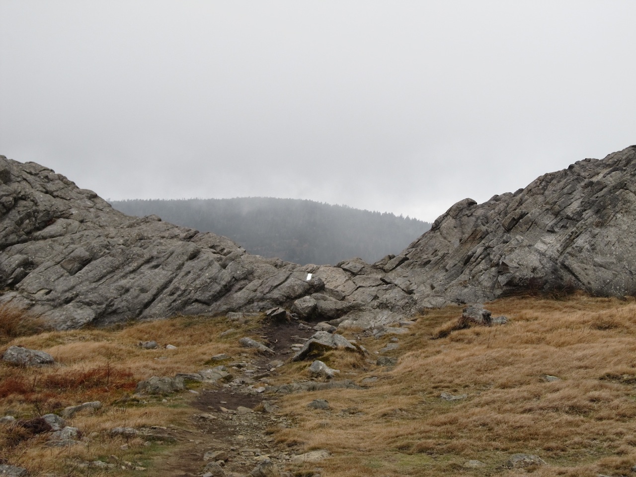
The hike itself crossed some pretty meadows offering plenty of gorgeous views, even for an otherwise dreary November day.  The terrain was mixed which made the hike consistently interesting; one moment I was climbing over rocks, the next moment I was in a dark forest or walking in a narrow path between two rock walls.  During a warmer month, I would likely have seen some of the wild ponies for which the park is famous; ditto on the rhododendrons. 


Striking View along the Appalachian Trail

At the start of the hike, there is a prominent sign warning about “extreme weather change”.  I would have to say that is sensible advice even if “extreme” here is not exactly at Mt. Washington levels.  There was easily a 15 degree drop in temperature by the time I reached the summit.  It was quite blustery at the higher elevation, and I was considering digging out my gloves from my backpack.  Also, depending on whether I was on the windward or leeward side of a slope, the visual appearance of the weather varied from sunny to ominous.  I suppose this more of a winter phenomenon though. 

Thomas Knob Shelter

Spur Trail to the Summit


The summit is not particularly spectacular.  It is overgrown with trees that collectively block any grandiose view that would otherwise be had.   On the top of a rock, there is a USGS boundary marker officially proclaiming the highpoint.  Around the marker are the recessed letters “U,S,G,S” in a very large font making it especially obvious.  The marker also has the triangle on it, so you know you have found the right one (see photo). 


USGS Marker at the Summit 

Nearby, within a 100 feet, one can find 2 more USGS markers! They are also on rocks.  These markers have arrows on them, in lieu of a triangle, and point in the direction of the true highpoint.  Many people come across the one and completely miss the other.  I tried searching for a third directional marker, but that was in vain.  Theoretically, there should be three directional markers which point to the boundary marker, hence the triangle symbol.  If anyone finds a third directional marker (4 total), let me know. 


Directional Marker (typically overlooked)


Other Directional Marker (sometimes mistaken for summit)


I took a couple of photos of the view from the top, but they hardly comprise my best photos from the hike.  Really, all of the beauty is along the way. 


View from the Summit (note the boundary marker)


Overall, this was a great highpointing trip!  Hiking to the top is so much more rewarding than a quick drive.  I had the place almost entirely to myself too, as I only chanced upon one other hiker the whole day.  This was a great place for some solitude and reflection.     


Another View from the Summit