 |
| Me at the True Summit of Mt. Hood! |
With all of my attention towards highpointing in states in
the south and along the east coast, it was time to finally head out west to try
my hand at some of the more notable peaks on the list. First though, I needed to improve my skill set
a bit. Spending most of my life in the
mid-Atlantic, I did not exactly have a lot of ice axe or rope team
experience. I decided to change that by
taking an 8-day mountaineering class on Mt. Rainier and then try out my newly
found skills on Mt. Hood.
The class was a mixed bag in terms of experience, but I
certainly learned many of the key skills I would need to successfully climb any
glaciated peak, having spent quite a bit of time learning how to properly use
my ice axe and crampons, how to travel on a rope team, and even how to run
protection and do crevasse rescues. With
no viable opportunity for me to summit Rainier, I was especially keen on having
a successful summit bid on Mt. Hood immediately afterwards, if I could get
it. Both of my mountaineering guides for the
class did their due diligence and recommended that I have a guide for the Mt.
Hood attempt. One of the guides though
said that he had easily soloed the mountain in the past, nonetheless, which I
took as a suggestion that I might be capable enough to do the same. So, I forwent having a guide and decided to
at least have a go at it on my own.
I guess I was pretty anxious to do just that. My class ended on the evening of Friday, July
5th, and I was already on a train to Portland the very next
morning. I walked directly from the
train station there to the car rental agency and found myself sitting in the
Timberline Lodge parking lot in full view of the southern face of Mt. Hood, not
even 2 hours later. There would be no
summit attempt in the middle of a hot summer afternoon, obviously, but I still
thought I could have an early glimpse for what I was in for. I walked for awhile and took in a closer view
of the mountain, and I tried to trace out some of the key features on the upper
mountain to figure out the route. I was
simultaneously reading up on the beta on SummitPost to determine the easiest
way to the top. With the upper mountain
looking deceptively small from my vantage point, I felt buoyed to give it a try
that very night! I was a man on a
mission, you might say.
 |
| Mt. Hood on a Beautiful Summer Afternoon (South Side) |
I hung around the parking lot a bit, called my wife to
inform her of my intentions, and figured out what gear and provisions I would
need. I eventually left to get dinner,
plenty of water, and even take a few establishing photo shots. Soon enough though, I was back in the parking
lot hunkering down for a few hours of sleep before heading off on an alpine
start for the top!
 |
| Turn-off Road for Timberline Lodge |
Folks with headlamps were soon being dropped off or were otherwise
making their way from the climber’s registration center to the climber’s trail,
for a similar attempt. I finally got
everything in order, including filling out my permit, and checked in at the
registration center by 2:20am.
 |
| Check Out that Flat Screen with Real-Time Updates! |
By 2:45
am, I was climbing!
 |
| So it begins... |
I should say a few words about the registration center, as it
is quite impressive! With no door, it is
open 24 hours a day, all year long. They
have quite a bit of warning information available for the would-be climber. They go so far as to have a flat screen
monitor posting real-time weather and avalanche updates. They have a video camera that records the
space for identification purposes, and it is a great chance to demonstrate the
gear that you will be taking for your proposed route. They also have blue bags should nature call,
and a bathroom and sink adjacent to take care of any last minute needs. All of the information, collectively, is
quite good at instilling the point that this is a dangerous undertaking, and
that one should be prepared accordingly.
I dropped off my form indicating my equipment (much more than I needed,
just in case) and proposed route, and I was on my way.
Apparently my early start was pretty late by Oregonian
standards, so I did not encounter anyone for quite some time along the
approach. I dutifully followed the
“Climber’s Trail” uphill and then farther uphill. It was a long trudge in the snow, interrupted
a couple of times to dodge some snowcats working in the area, presumably
grooming the ski runs. I made my way up
to one of the huts, but I did not see anyone there or a way in. I continued up farther along a nicely groomed
ski run. I think they prefer that you
stay off the ski runs, but at this hour, it really didn’t matter. The slope was steep, but I opted to forgo
crampons, choosing instead to proceed with careful placement of my feet and ice
axe. Slowly and methodically, I made my
way to the top of the ski run. I could
finally see some headlamps in the distance ahead of me along the upper mountain
as well as a group of headlamps behind me, emerging from one of the huts.
 |
| Headlamp Pierces the Dark Night and Reveals a Nicely Groomed Ski Slope |
I made my way farther up to a triangular-shaped
moraine. It was pretty sizable, and it
was a great chance to throw on the crampons.
The snow was still hard at this hour, so I definitely wanted more
traction, if I could get it. The smell
of sulfur abounded in key spots along and near the moraine. Other than that, it was pretty chossy.
 |
| One of a Handful of Moraines |
Finally, the darkness began to lift, and the sun began to
make an appearance. The views were
dramatic along certain angles. Above, I
could see the upper mountain much more clearly, making me realize that there
was still much more left to my approach.
Beyond though, I could see clouds lying in the valley below, and distant volcanoes at eye-level. The views are as beautiful as they are addictive, and are quite inspiring to boot. I could not dwell too long though, as I still had a lot more mountain ahead of me.
 |
| Upper Mountain at First Light |
Beyond though, I could see clouds lying in the valley below, and distant volcanoes at eye-level. The views are as beautiful as they are addictive, and are quite inspiring to boot. I could not dwell too long though, as I still had a lot more mountain ahead of me.
 |
| What a View to Start the Day! |
I continued farther along the approach, following footsteps
in the snow where I could find them, and hopscotching across moraines
otherwise.

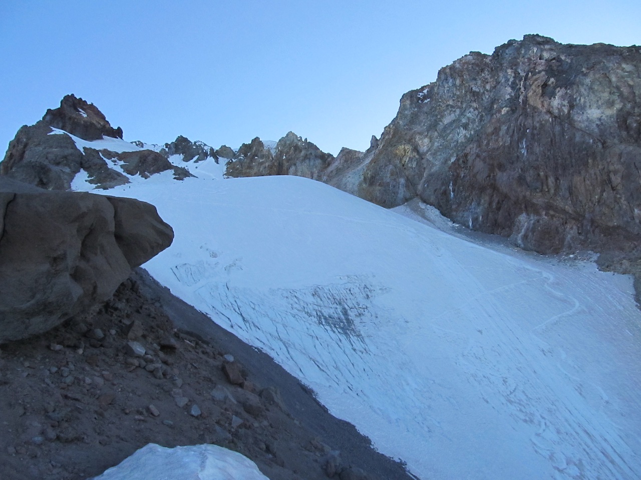
Eventually, I came around to the very famous Hogsback Ridge, which brought into full view, the path to the summit. It also brought into full view, some of the surrounding dangers. I could see rocks strewn about and see the occasional rock fall. I had my climbing helmet on, but I still needed to be mindful in this section. I could also see a gaping crevasse that I needed to be careful to avoid, by NOT falling along any part of the remaining approach. The Hogsback ridge itself was interrupted by a bergschrund which at the time of my visit was impassable, so the route proceeded west to a nearby moraine and went to the summit from there along a fairly steep chute.
Eventually, I came around to the very famous Hogsback Ridge, which brought into full view, the path to the summit. It also brought into full view, some of the surrounding dangers. I could see rocks strewn about and see the occasional rock fall. I had my climbing helmet on, but I still needed to be mindful in this section. I could also see a gaping crevasse that I needed to be careful to avoid, by NOT falling along any part of the remaining approach. The Hogsback ridge itself was interrupted by a bergschrund which at the time of my visit was impassable, so the route proceeded west to a nearby moraine and went to the summit from there along a fairly steep chute.
 |
| Hogsback Ridge Ahead, Chute to the Left |
 |
| Looking Back from the Moraine towards the Hogsback |
The ridge had some inherent danger, but I actually felt comfortable there. It was only when I made my way over to that last moraine that I felt the need to pause for the first time. The chute is very steep and considerably long. This was going to be a sustained session of climbing with my ice axe to the summit ridge. If at any time I slipped and fell, I likely would not be able to self-arrest my fall with the ice axe due to the steepness of the chute. What lied beyond was the rocky moraine and a large crevasse. Yikes! To complicate matters, earlier climbers were making their descent from the summit ridge along the same chute, so there was some traffic management to take into account as well.
 |
| The Chute! Steep and Long. |
After a good 5-10 minutes, I sighed, and decided to press
onward. I really did not want to leave
without a summit. I kicked my steps
hard, anchored my ice axe higher and again higher, and made eventual progress
up the chute. It felt slow and interminable,
even though I was actually moving at a half decent pace. Really, that chute just seemed to go on
forever. About 2/3rd of the
way up, I encountered a rope team of 4 people heading down. Looking face to face with the lead member, I
asked what the climbing etiquette was in this situation. He answered that the downhill team had the
“right of way”. Really? Ugh. I
quickly anchored out a spot immediately to the right and waited and
waited. This rope team was in no hurry
to get down which I would not care about it, if not for the fact that I was
precariously hanging out on the edge of a pretty steep slope with no rope
whatsoever. Could you please hurry up, I
thought to myself? They apologized and
passed in turn. It was probably better
this way though. As uncomfortable as I
was, some of the folks on that rope team looked really uncomfortable. It was probably easier for me to move.
As I reached the final crux, I swear the slope was even
steeper – good lord! I edged out a seat
to my right and got situated. Wow! For the first time I could see over the top
to the other side. The view was
incredible! It was just as encompassing
and panoramic as the south side view I had been having all morning up to this
point. Better yet though, I could see 3 more volcanoes including, the ever lovely Mt. Rainier.
 |
| Summit Ridge! First Look at the North Side! |
I did it! Or so I
thought. A Russian climbing team came up
to the summit ridge soon after me, and they were pressing onward. Huh? I
wasn’t sure if this counted as the summit or not. They wanted to go on a little farther to a
mound of snow that looked visibly higher.
I kindly took a photo of them at this higher vantage point, but I was a
bit sheepish to really move any farther along the summit ridge than I had
to.
 |
| Russian Climbers at the False Summit |
After some deliberation though, I
reasoned that if I am trying to highpoint, then I really need to get over to
that snow mound and take a self-photo there as well, just to cover my
bets. I eventually managed to do as
much.
 |
| I Thought I Was at the Summit Here! |
Soon I was joined by a climbing team of skiers, a couple of
whom were planning to ski down from the summit ridge, once the snow warmed up a
bit in face of the ever rising sun. To
sink my spirits entirely, their leader, Kurt, informed me that the “true summit”
was still a bit farther on, maybe a good couple hundred yards in the
distance. Indeed, in the distant view
along the knife-edge ridge, I could see a small tripod-like structure that
really did mark the true summit. If one
word came to mind, it was “fuck”.
 |
| See that Tripod in the Distance, between the 2 Climbers??? |
Yes, by continuing with the logic above, for this highpoint
to count, I needed to continue along that corniced ridge for a quite a bit of
distance, yet. Everything I did so far
was just not enough to count. The
decision to proceed was complicated, of course, by the 2000 foot drop-off to my
left and the 700+ feet drop-off to my right.
Cornices and softening snow just made it more interesting. Climbers call this “spicy”.
 |
| DO NOT FALL! |
I let the climbing team pass and deliberated a bit. Kurt said that I really did all of the hard
parts already; this was easy in comparison.
He also advised me to breathe.
Yeah, this was less than easy for me.
I eventually relented, though. It
probably all happened in 5 minutes, but it felt like awhile. I made my way down a tiny hill along the
ridge, and from there it was actually pretty easy to keep walking, with the
exposure reduced significantly.
 |
| Whew! Getting Closer! |
I soon found myself among the two climbing parties in front of a tripod structure with a red metal box on top. This was it! The red box was the summit register! I really did make it to the top at this point – yay!
 |
| Summit Register |
 |
| Me at the Summit Register -- I MADE IT!!! |
I signed the register and indicated that it was my 27th highpoint. I also wrote that I love my wife, Natasha. I was thinking ahead to the climb down at this point, and I wanted to have that in writing, in case I didn’t make it. :-)
 |
| View from the Top! |
I had a few photos taken of me at the summit, and I actually
hung out for awhile chatting a little bit with some of the others. The views were incredible! The conditions at the top were pretty
amazing, too. I swear there was almost
no wind to speak of, and it was starting to get warm out – even at the
summit.
 |
| Another View from the Top! |
After taking in the enormity of what I just did, I set out
for the long climb down. Traversing the
summit ridge was easier on the way back, but I had a seat again once I got back
to the chute. All of a sudden I realized
that as hard as it was to climb up that chute, it was going to be even harder
to climb down it. The motions would be
the same for me, as I was planning to face inward to the slope on the way down,
and re-use many of the hand- and footholds where I could. Nonetheless, I could not get over the
psychological leap it would take to get past those first couple of steps. It is hard to go from a seated position on
top of a wall to a kind of hanging position, with no security to speak of. At least for me it is.
The Russians soon made their way back to me. They had a rope. Hmm…
In my trusty bag, I had an alpine harness (just in case). I asked if I could tie in with them, and they
obliged me. Having free soloed all the
way to the true summit, I figured it wouldn’t matter what I did after that
point to get down. So, I tied in with
the Russians to safely descend the chute.
Sometimes it’s just a psychological barrier, because once I tied in, I
had no problem at all descending the chute.
I even did it pretty quickly feeling especially comfortable in my
movements and technique. It still took a
long time to reach the moraine though.
That is just one long chute!
Once I arrived back at the moraine, I untied and thanked my
new Russian friends for their assistance!
They said I would have done the same for them. I would have, too. I looked above and saw two of the skiers, ski
down. Yikes! They were in seemingly full-control of their
movements though, so all the power to them.
I said goodbye to the Russians and continued to head down on my own,
sans rope.
Heading down Mt. Hood should not be underestimated. There is over 5000 feet of elevation loss,
and that just takes time to get through, even if you are plunge stepping most
of the way. It was a good deal of fun
though, with the ski resort slowly coming into fuller view as I descended. The moraines were less fun going down, so I
spent more time descending in snow. When
I made it back to the active ski area, I followed the sign for climbers and
made my way well to the left of all the action.
Descending continued on and on, and then farther on still. I eventually ran out of snow and removed my
crampons. I still had a little bit of a
walk yet to the climber’s registration center.
I eventually signed out at the registration center, cleaned
up some in the washroom, and made my way back to my rental car. It felt so good to get out of those boots and
change into sandals and street clothes.
Sigh! Now I could relax and just
enjoy the day. I tried my hand at a big
lunch at the lodge, but it was overpriced and terrible. Oh, well.
Fine dining and mountaineering never overlap, it would seem.
All in all, this was an amazing
climb! I would strongly recommend having
a guide though. I saw one of the
Timberline Mountain Guides with a group of climbers near the summit. They confidently navigated their way down the
chute after managing a pretty early summit time. That’s really the right way to do it, but it
is pricy ($500+), and you have to know what your plans are well in advance of
the climb. If you are comfortable with
an ice axe and deadly exposure, then soloing is a viable alternative. If you are a highpointer and intend to go all
the way to the true summit and sign the register, definitely pick a cloudless
day with little to no wind. There is no
reason to make this any more difficult than it already is. Also, be careful on the descent. Following the path of gravity (in conditions
of reduced visibility) will actually lead you away from the Timberline Lodge
and have you fall into a canyon. You
should definitely pack a compass.
Of the 27 highpoints I have done
so far, this is the best one – hands down!!
 |
| Parting View from the Safety of my Plane Seat |
No comments:
Post a Comment