 |
| Vanity Shot at the Summit of Mt. Marcy |
Only a few weeks back from Oregon, and I was already itching
to do another highpointing trip. It’s
funny how that works. The more states
that one completes, the more intense the desire is to complete the remaining
states. It’s an incredible fixation that
takes me farther and farther afield.
Fortunately, this time around I had my sights on the relatively close
state of New York, a state I have grown to know quite well having lived there a
couple of times in the past.
The highpoint of New York is Mt. Marcy, which is an impressive
mountain in the heart of the Adirondacks.
Obviously the highest of the 46 high peaks in the surrounding
wilderness, it comes in at a commanding 5,344 feet. The approach involves 3200 feet of elevation
gain across a 15-mile round trip hike.
So, all together a hike of moderate difficulty, made more difficult by
my attempt to make it a day hike, leaving from Washington, D.C. Yes, I am a sucker for endurance
efforts.
I was able to leave my place at 5:15am on a quiet Friday
morning. I opted to take a route that
avoided tolls and all of the morning traffic of Baltimore, Philadelphia, and
New York City. Instead, I headed north
to Harrisburg, PA and continued to follow a slant pattern once I entered New
York state. The New York portion of the
route was scenic and relaxing, taking me past the Baseball Hall of Fame in
Cooperstown and onward to Albany. From
there, I had to head a bit farther north into the Adirondacks proper, and turn
off on some country roads, eventually making my way towards Lake Placid. I finally pulled into the parking lot of the
Adirondack Loj nearly 9.5 hours later. I
have to say, for an early Friday afternoon, I was impressed with all of the
parked cars at the various trailheads alongside the roads leading up to the
Loj. There was opportunity for adventure
everywhere, and seemingly hordes of people were embracing those
opportunities. I can only imagine how
busy it is on the weekends!
The parking lot for the Adirondack Loj is not free. Because I arrived in the afternoon, I paid
the reduced fee of $5, and because I was paying by credit card, I had to go
into the Loj for the transaction. I
managed to find a parking space in the nearly full parking lot, paid the fee,
and inquired about the trailhead for the Mt. Marcy. Apparently, it was just ahead at the end of
the first lot. So, I grabbed up my gear
(a small pack, rain suit, headlamp, GPS, water, food, and poles) and headed
off. I signed in at the register, just
minutes before 3pm.
 |
| Hiking Register #1 |
 |
| Bear Country! |
The trail begins by heading out to Marcy Dam, which is a
major campground area and an excellent launch area for a number of hikes of
varying difficulty. The approach to the
dam was pretty straightforward with only a little bit in the way of net
elevation gain. The terrain was boggy,
but the going was made easy by a number of boardwalks, terraces, logs for
stepping, and rocks for hopping.
 |
| One of the Many Boardwalks near the Start |
In the
couple of miles to the dam, I saw easily dozens of people hiking back to the
main parking lot, calling it a day. I
saw no one heading in my direction. I
guess this was a pretty late start by Adirondacks standards.
 |
| Entering the High Peaks Wilderness |
When I arrived at the dam, I made my way down to the
pedestrian walkway and crossed over the water.
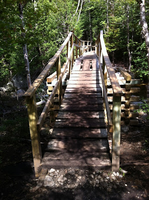 |
| Pedestrian Bridge across Marcy Dam |
 |
| View from the Bridge |
On the other side, I arrived at a second trailhead replete with a second
hiking register. I signed in there too,
and was quickly on my way again.
 |
| Hiking Register #2 |
From here the character of the trail changed a bit. I was now definitely heading uphill, and
rocks were ever plentiful. Always ensconced by trees, I was walking atop
strewn logs to avoid mud, around large rocks, and at times climbing over
them.
 |
| Typical Section of the Trail |
The number of parties heading down diminished quite a
bit. I started to encounter rangers from
time to time though. The first one asked if I was heading to Phelps, and was worried if I would have enough time
to make it to the top of Marcy when I told him I wasn’t. I assured him that I had a headlamp and was
fine with routefinding in the dark, if need be.
The second ranger also expressed concern. She told me to be careful, because she would
be the one coming out to look for me if I had any issues. Um, okay. The third ranger was a bit more relaxed. I guess I was high enough up the mountain at
this point, that she wasn’t too concerned about me. She said that they just had to evacuate
someone earlier, so that’s why the rangers were being so cautious. I was going to say. Hiking up Marcy was not particularly
demanding for me, so I was able to keep a strong pace heading all the way
up. What’s the worst that can
happen? Maybe I fall, hurt myself a
little and have to hike or limp down in the dark by headlamp? Meh, it’s not really a big deal for me. I guess they see a lot of inexperienced
hikers though, so who knows what they get to deal with.
Eventually, the trees opened up a little bit, and I was able
to see my first view off into the distance.
It was beautiful!
 |
| First Tree-Free View |
Seeing distant
peaks at eye level, I knew that I was finally getting close to the summit. A nearby sign indicated that I was in the
final 1.2-mile stretch. Indeed, I could
see the summit off to my right in the distance.
Apparently, the path was going to spiral its way up there along the
way. I was energized to pick up the
pace.
 |
| First View of the Summit |
I soon came to the final junction, and made a right for the
summit. I came into the alpine zone and
began scrambling to a lower peak just shy of the summit.
 |
| Alpine Zone near the Summit |
 |
| First Pitch of Scrambling |
It was easy class 2 rock, that yielded an
amazing view once climbed. The view of
the peaks off into the distance was pretty clear and inspiring.
 |
| Summit Looms Closer |
 |
| Views are Pretty Nice Here |
Sadly, I did not tarry long so as to keep
pushing for the summit. One last pitch
of class 2 rock, and I was there!
 |
| 2nd Pitch of Scrambling |
I quickly spotted the summit plaque and did my usual photos
with the requisite vanity shot.
 |
| Vanity Shot at Summit Plaque |
 |
| Detail of Summit Plaque |
Clearly the rock holding the plaque rose still higher, so I
made my way up it to the summit plateau.
There I searched around for a USGS marker, but I did not see one. I guess the plaque is sufficient. Upon the plateau though, I had a full,
unobstructed panoramic view for the first time.
It was quite gorgeous, from what I could see.
 |
| View from Summit Plateau |
Unfortunately, the clouds were pretty low
hanging at the time of my summit. So, in
actuality, I had better views from the peak below.
 |
| View from the Top: Note the Clouds |
The clouds were a little too dark for my
taste given my then current position at the highest point in New York. I was hearing sounds of thunder on the way up
too, but any storm activity was still off in the distance. Regardless, I figured it best not to stay
very long, lest I serve as a lightning rod.
I decided to take what photos I could and make my way down below the
treeline as quickly as I could.
 |
| Detail of Boreas Ponds Below |
The true scrambling stretches were pretty easy to
descend. Amazingly, I passed someone on
the way up at the last junction. He had
a medium-sized pack with a bear can, so I figured he was planning to camp
nearby after summiting. He looked pretty
experienced, so I wasn’t worried about him.
I can only imagine what the rangers thought about him climbing the
mountain even later than me. Not to be
out done though, I soon encountered a trail runner still on his way up! He had next to nothing in the way of gear,
but he was running up rock at a full clip.
This should be interesting, I thought.
Sure enough, it was. Maybe an
hour later, as I was dutifully making my way down the mountain, I could hear
him running in the distance, this time even faster. I moved to the side and yelled towards him
asking if he made it to the summit? He
yelled back that he “tagged it”. I
congratulated him, and he passed by in a whirr.
Seriously, he was just flying down a rockslide like it was a perfectly
groomed trail. I never have seen anyone
move that fast down a fairly rugged trail before -- damn! I was impressed.
I continued to make my way down as the sun slowly began to
set for the day. The remaining daylight
slowly diminished. The canopy of trees
soon blocked out any visible light. I
had to switch over to my trusty headlamp at this point. No big deal really, as I have been in this
position before highpointing Vermont and also Massachusetts (neighboring
states, coincidentally). The only
problem was that my batteries were weak, so I had a significantly reduced
beam. Damn! This would prove to slow me down quite a bit,
but the route was still pretty fresh in my mind, so no real worries.
 |
| Getting Dark! |
I soon found the crossing point for the river, forded it,
and made my way back to the Marcy Dam campground and signed out at the second
hiking register. It was just after 9pm,
and I still had more than 2 miles to go to get back to the Adirondack Loj. I crossed the pedestrian bridge, and started
to make my way through the dark of the forest.
My headlamp was really weak at this point, to the point where I was just
casting enough light to see the next tree.
Fortunately this was the easiest part of the trail by far, and it was
quite well marked. I often could see a
trail marker on a tree and know that I was fine. Also, all of the boardwalks and terraces made
it pretty easy to stay on track. It was
kind of fun to navigate under these conditions, really. Though next time, I will make sure my
batteries are new.
 |
| Adirondack Loj |
I eventually made it to the trailhead, signed out, and
walked by the Loj. My ascent of Mt.
Marcy was complete, and it was a great success – yay! I threw my gear in the car, and prepared for
the long ride home. 9.5 hours to go –
ugh! Sadly, it would prove to be too
much for me. Even with the spirited
assistance of Red Bull, my PED of choice for these kinds of trips, I was
feeling really tired on the drive home.
I decided to break up the trip by stopping at a rest area in NY and
another one in PA taking a couple hours of sleep each time. It was just enough to do the trick, and I finally
made my way the rest of the way home. I
managed to pull into the garage at almost exactly 10:15 am, making for a
29-hour journey in total. Without the
sleeping, it could have been a legitimate “day” trip, defined as not exceeding
24 hours. Oh, well. It was a great bit of fun regardless.
I have to say, I was pretty inspired by the climb of Mt.
Marcy and the surrounding area. It is
one of the ADK46 high peaks. I might
just be tempted to climb the remaining 45 mountains and earn my patch. Hmm… :-)


No comments:
Post a Comment